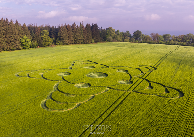
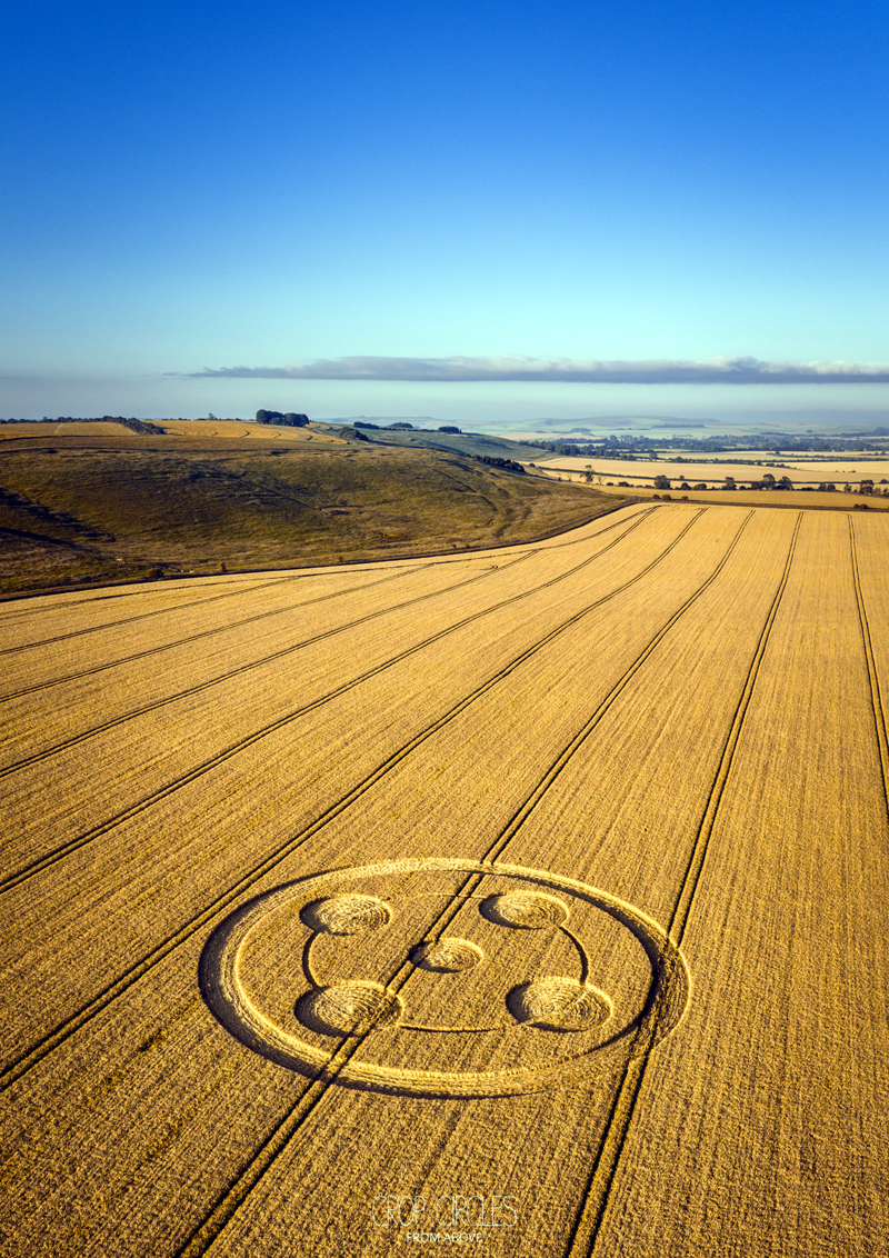
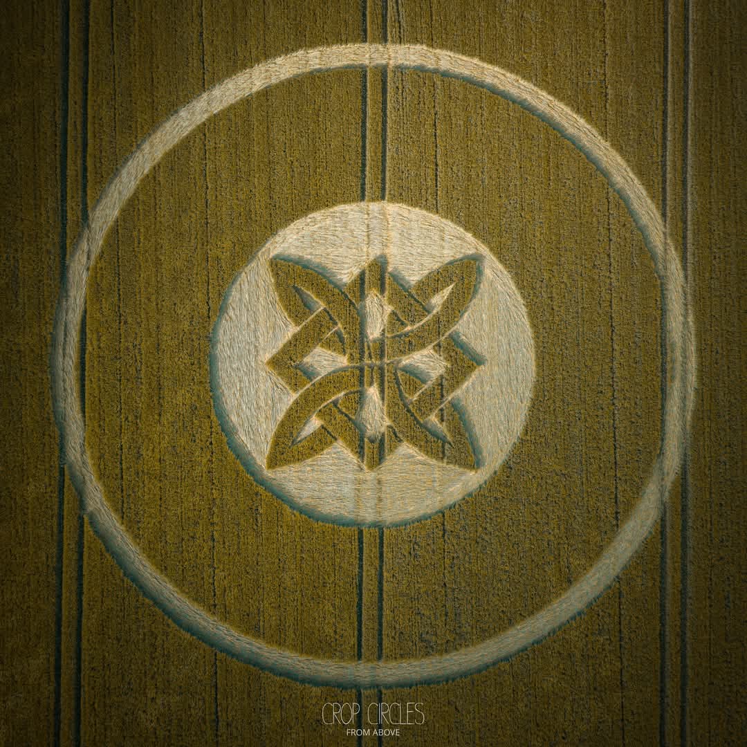
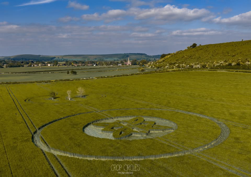
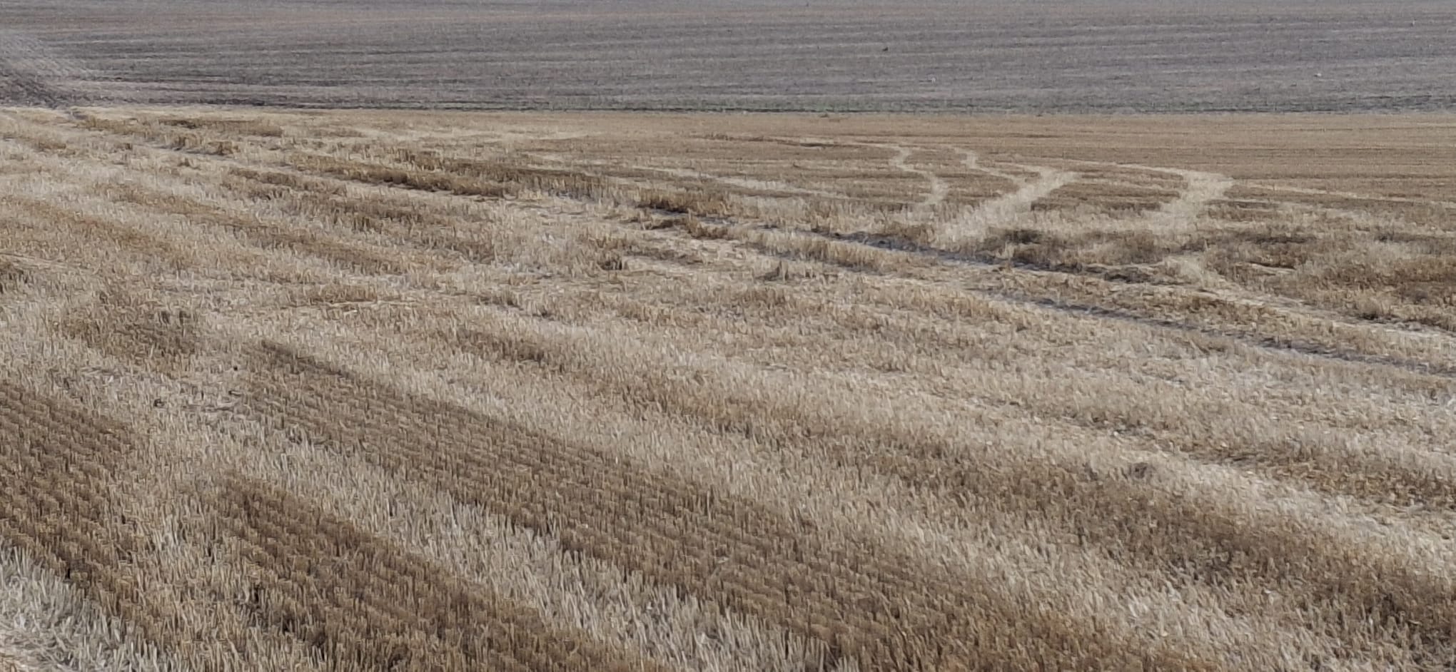
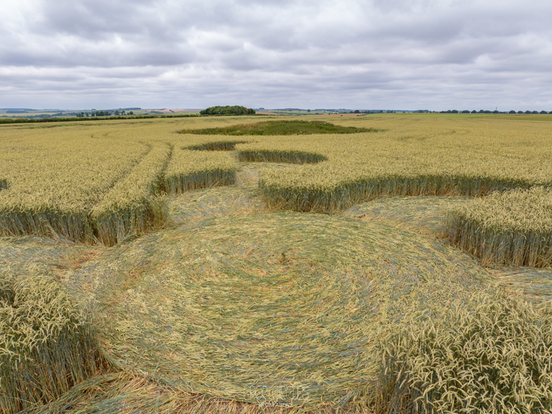
22 May 2026
White Sheet Downs, Nr Mere, Wiltshire, UK
Map Ref: ST7995735447
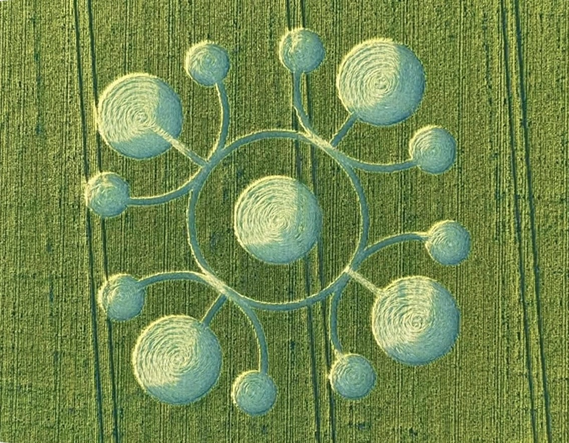
Crop: Barley
Size: approximately 75 meters
Photos Nick Bull; Crop Circles from Above
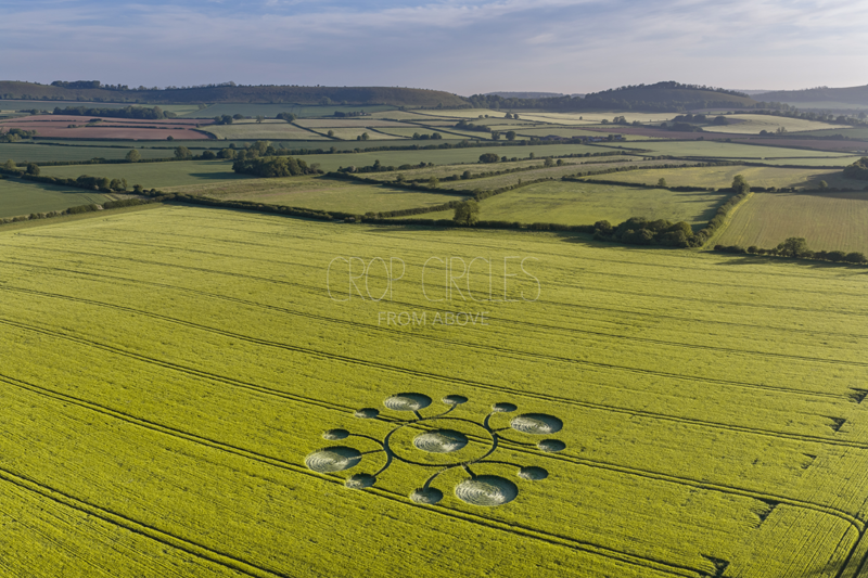
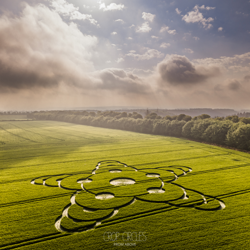
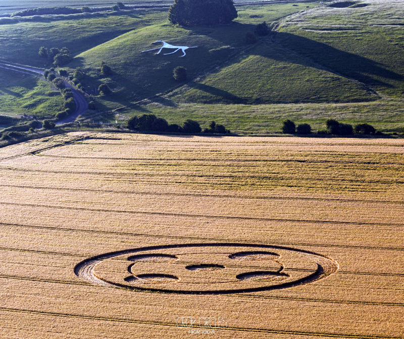
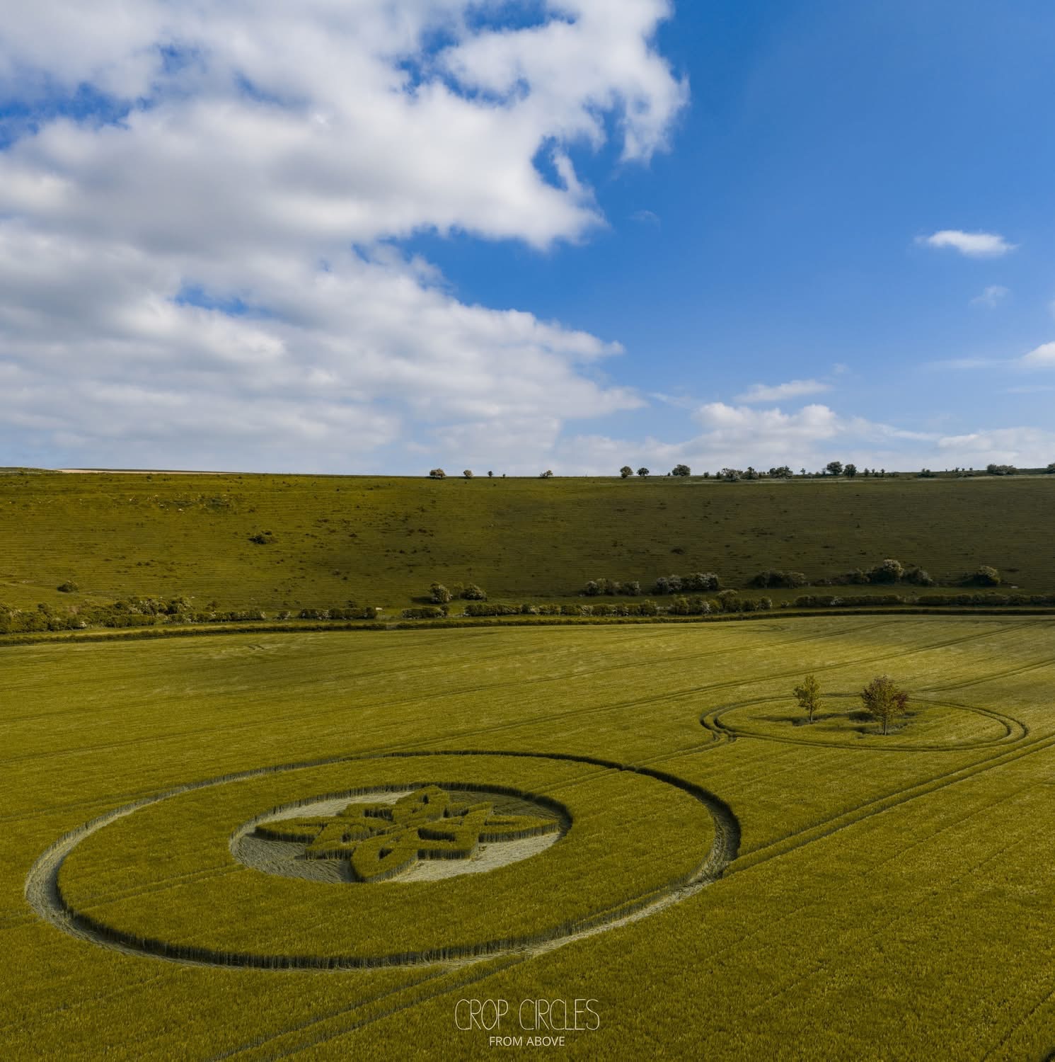
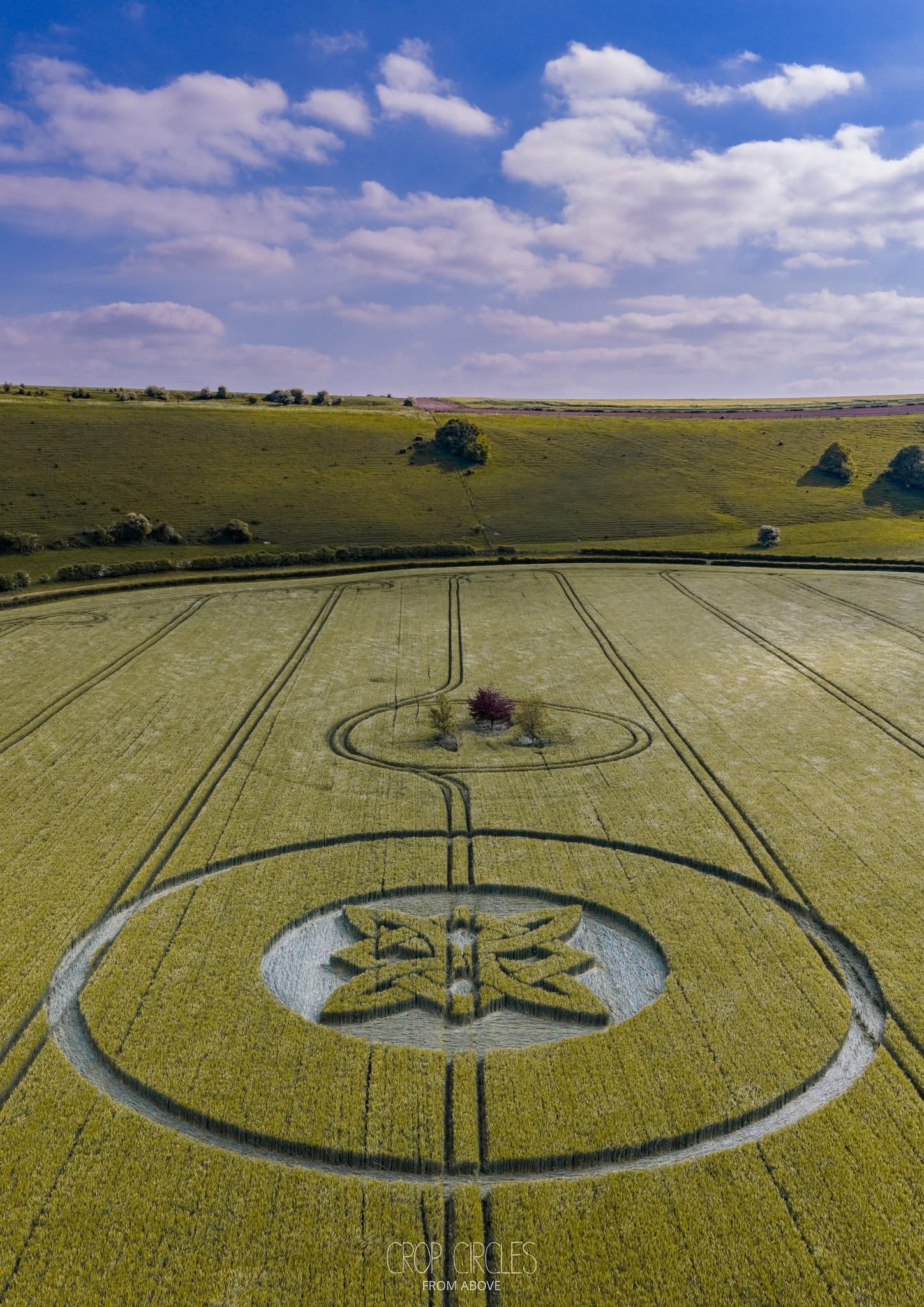
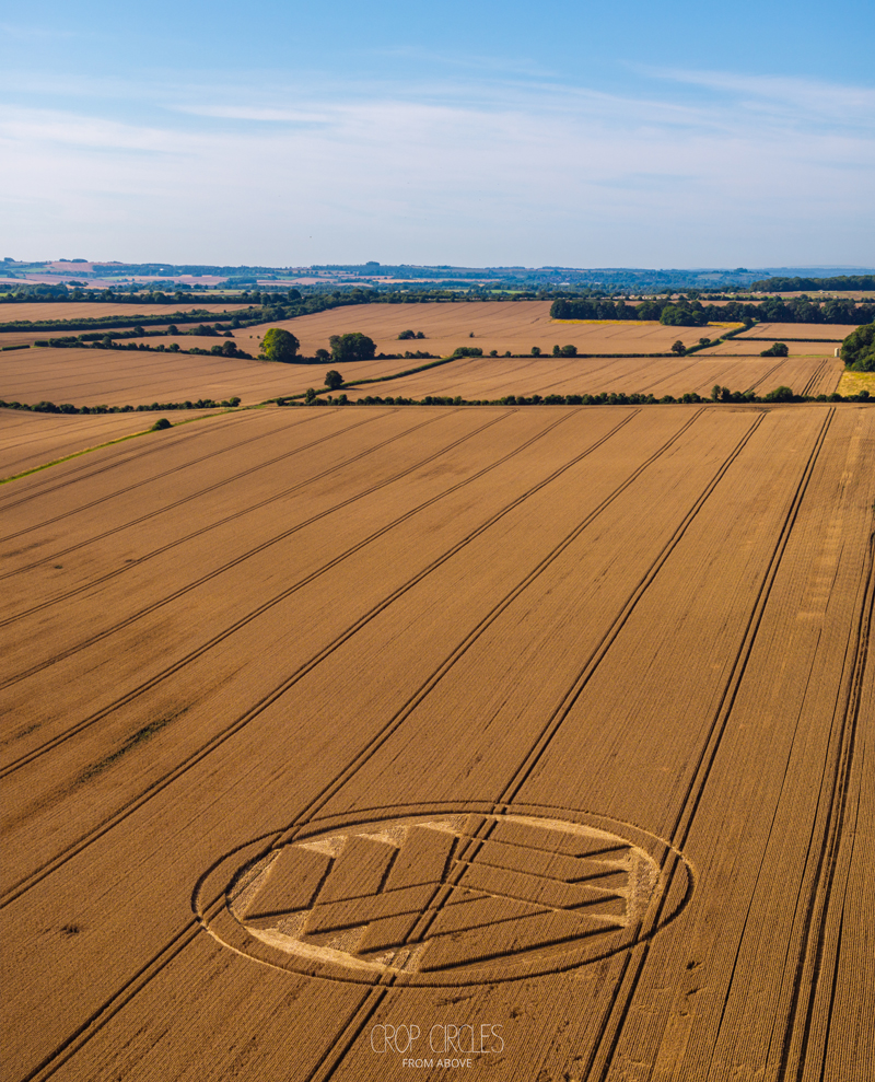
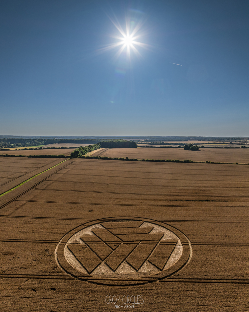
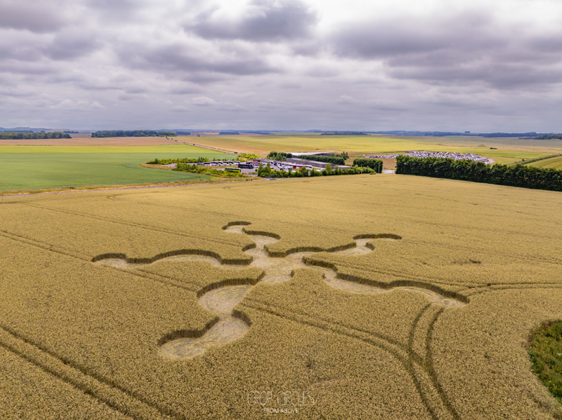
8 May 2026
Jack’s Castle Plantation, Near Alfred’s Tower, Somerset, UK
Map Ref: ST7494035495
Crop: Barley
Size: approximately 75 meters
Photos Nick Bull; Crop Circles from Above
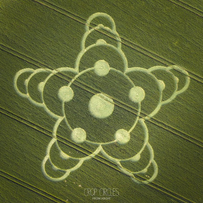
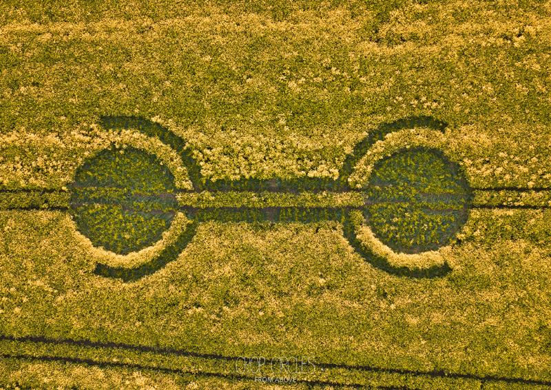
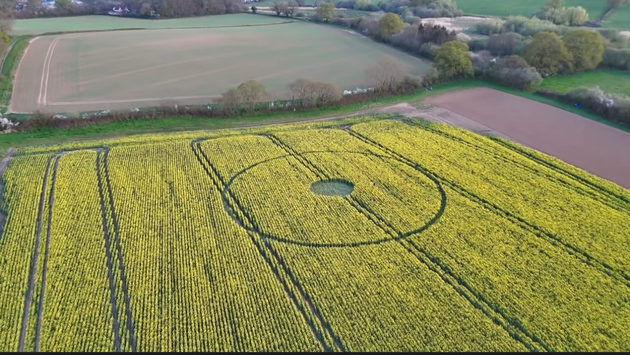
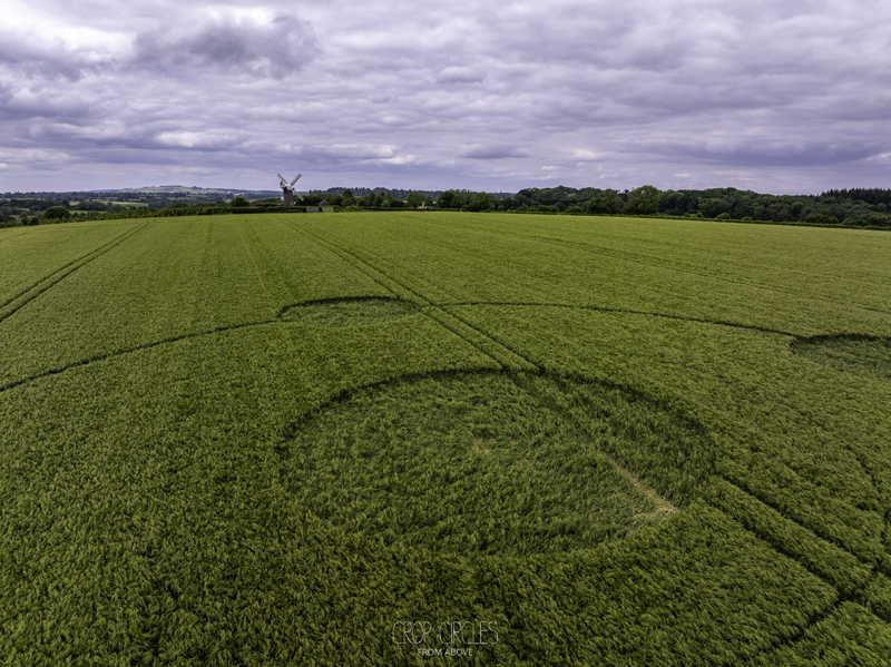
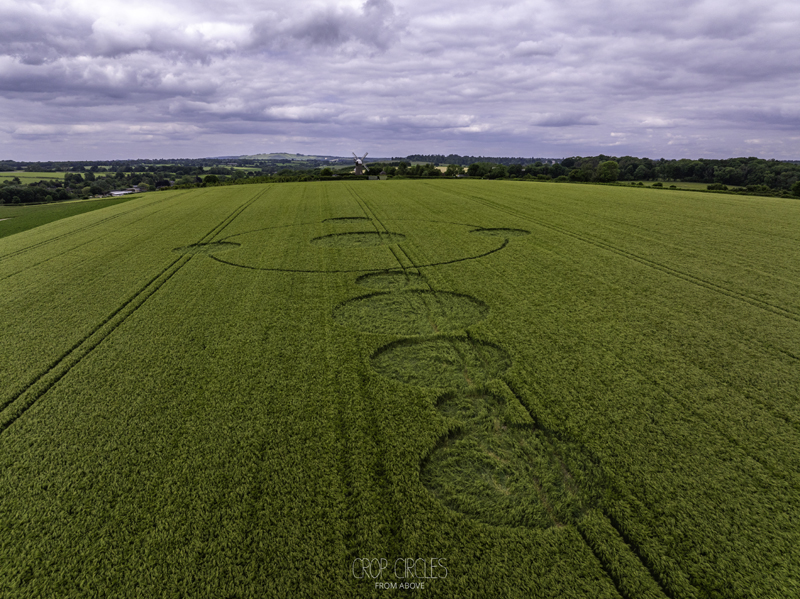
29 April 2026
Waden Hill, near Avebury Wiltshire, UK
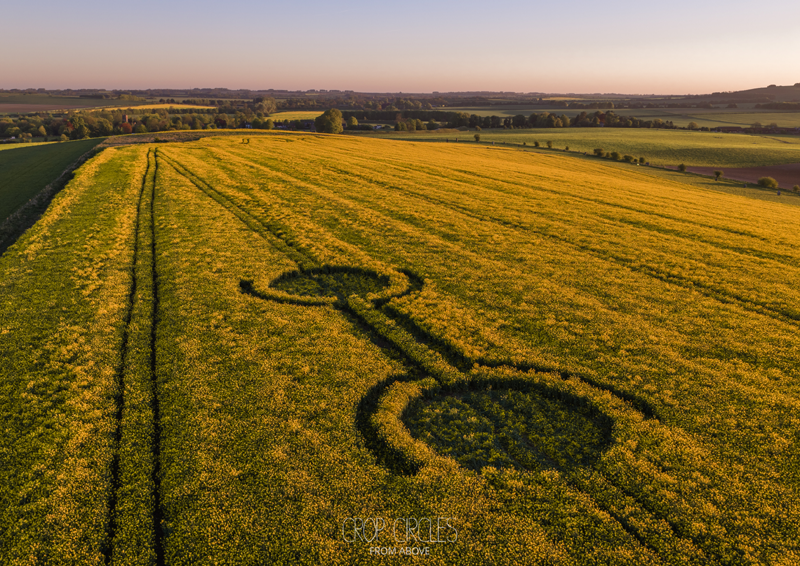
Crop: Oil seed rape
Size: approximately 25 meters
Photos Nick Bull; Crop Circles from Above
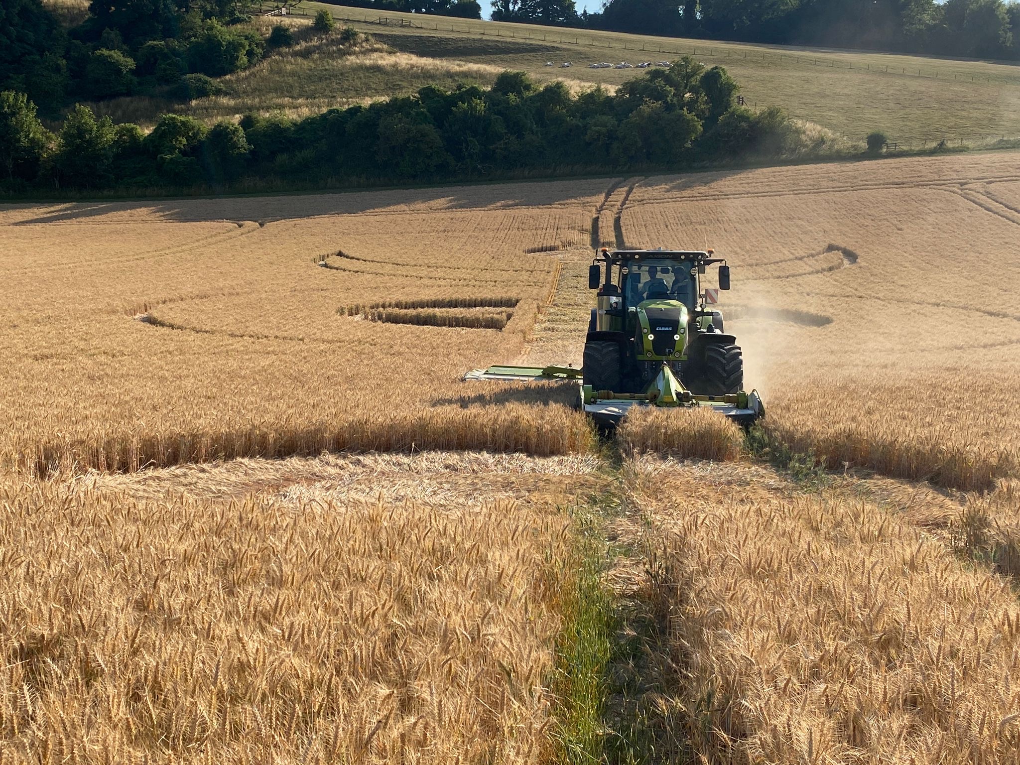
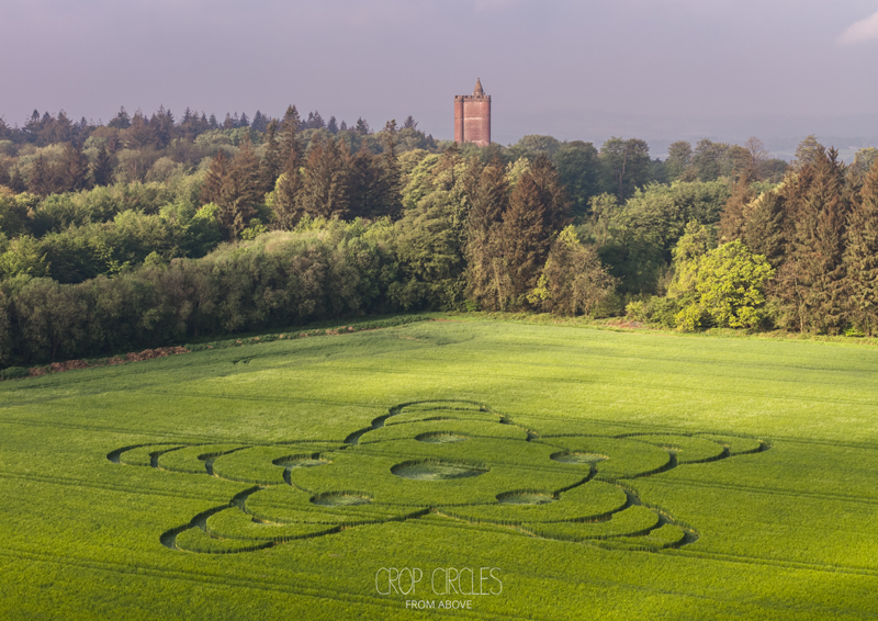
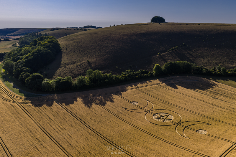
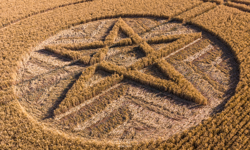
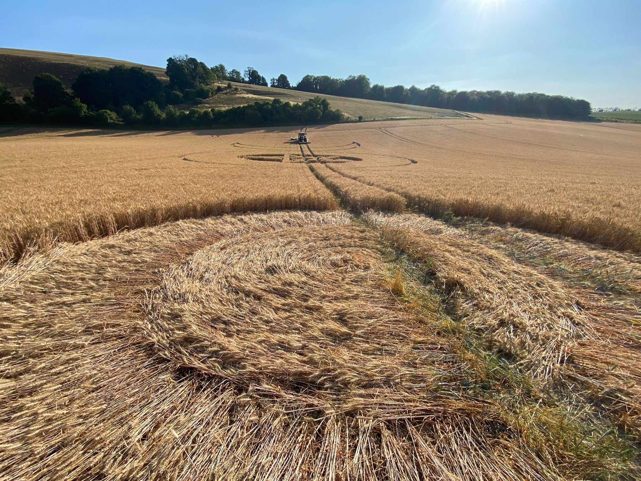
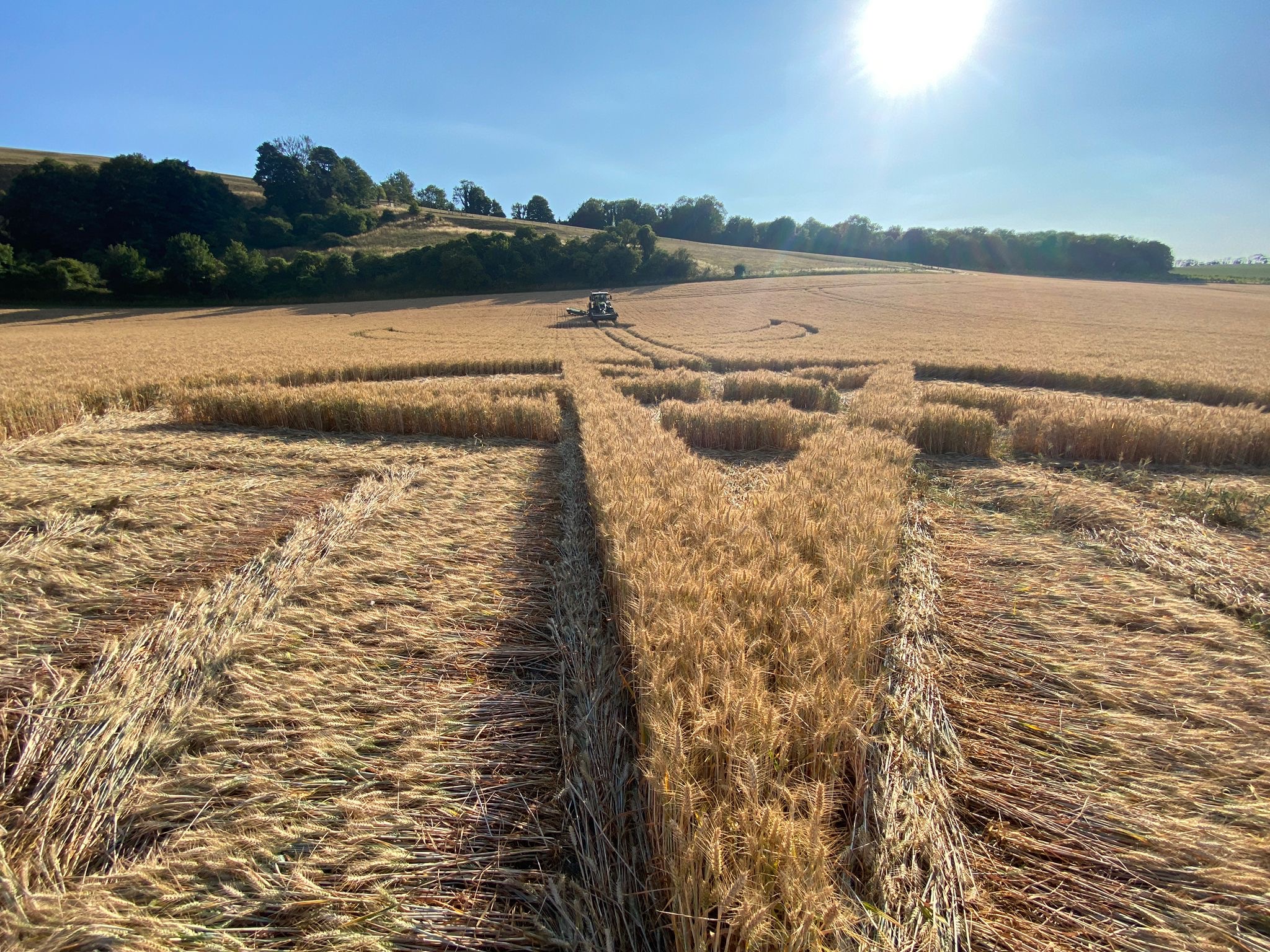
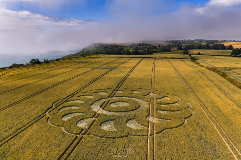
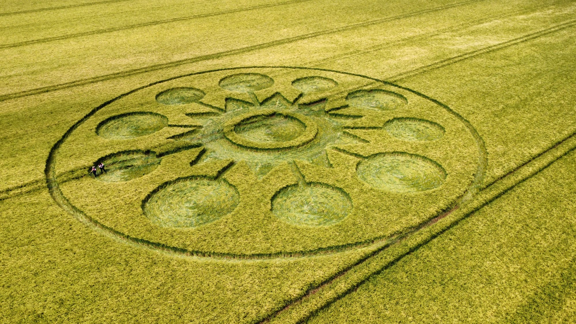
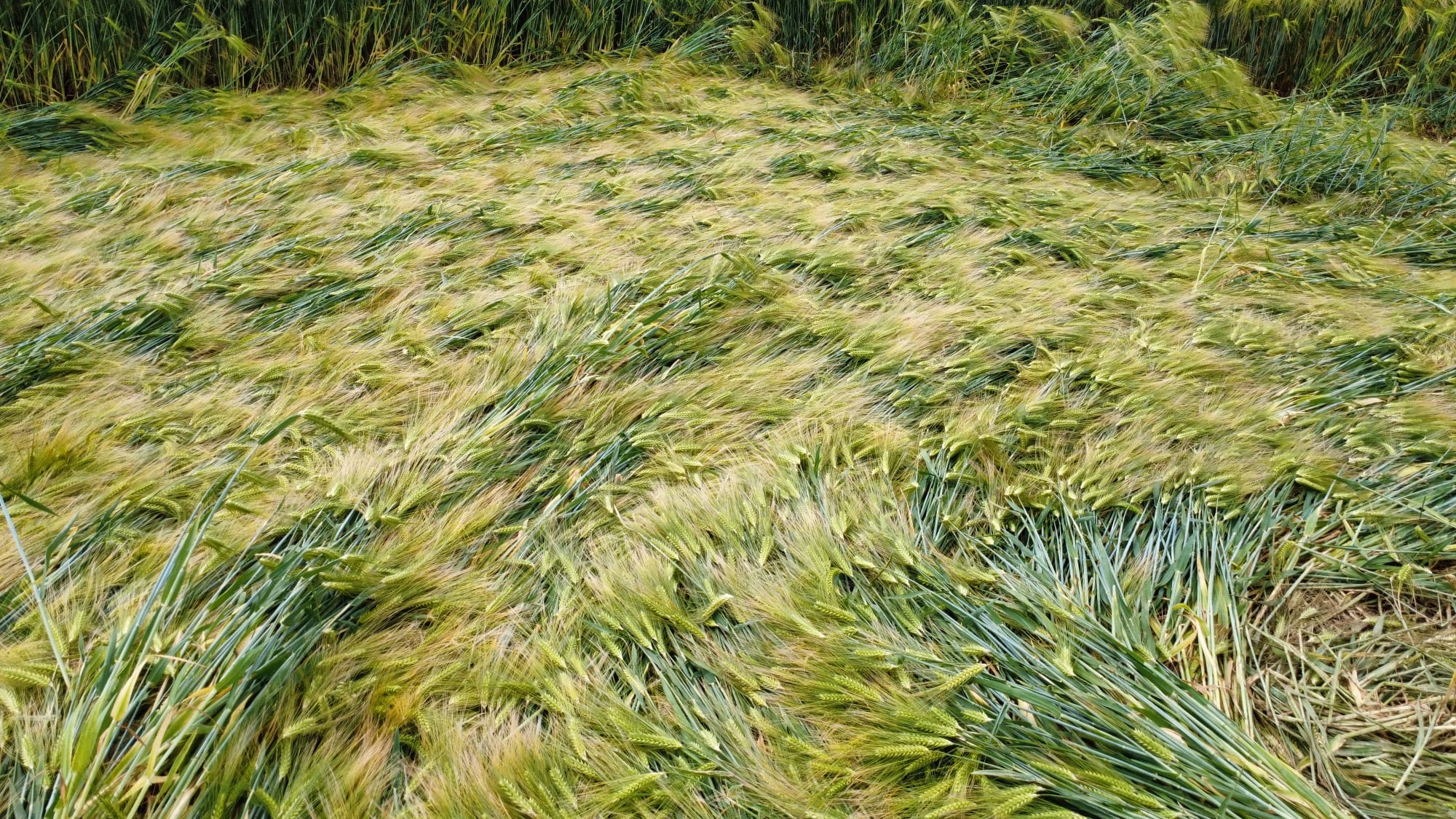
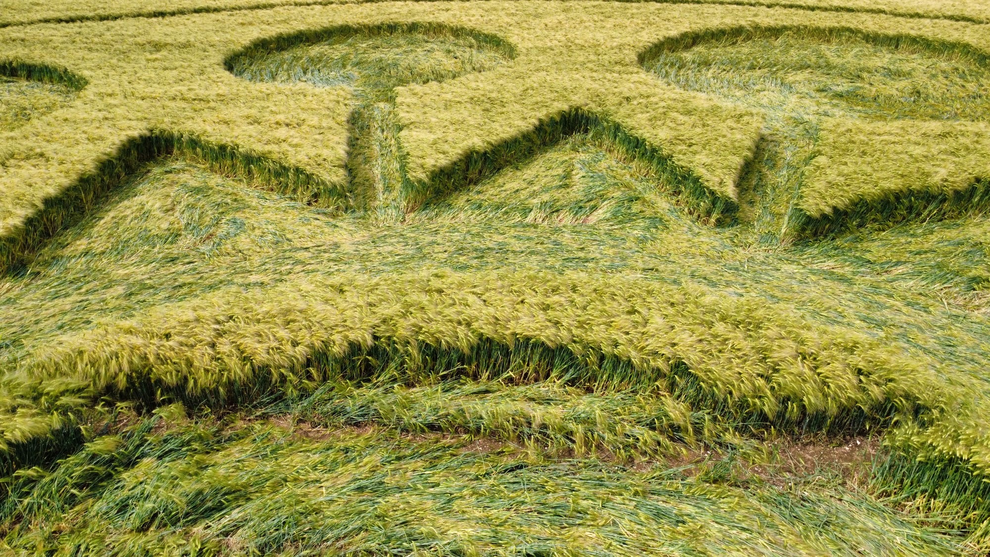
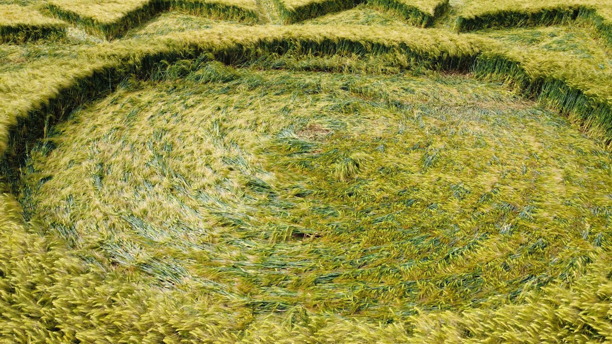
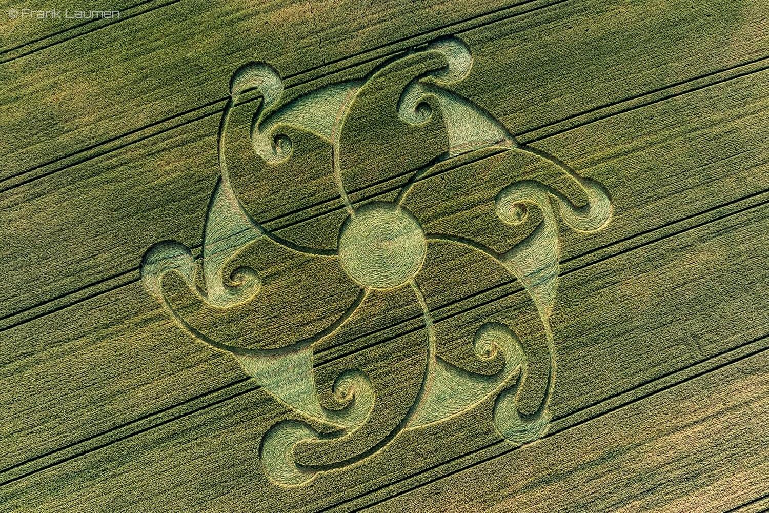
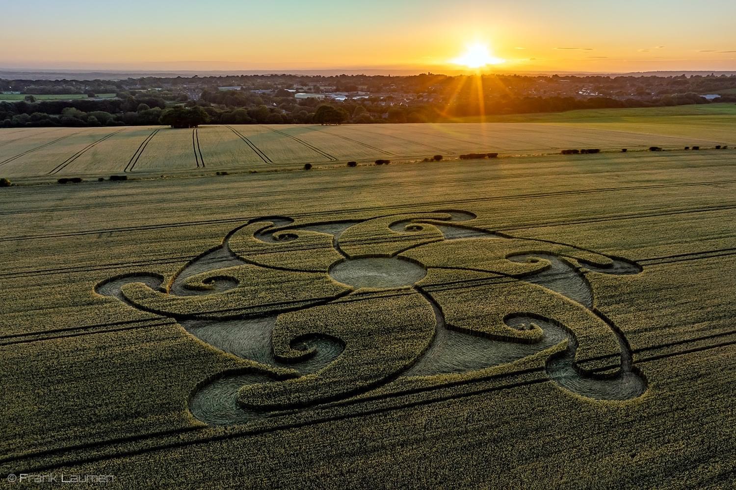
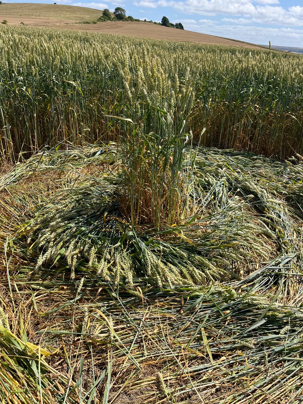
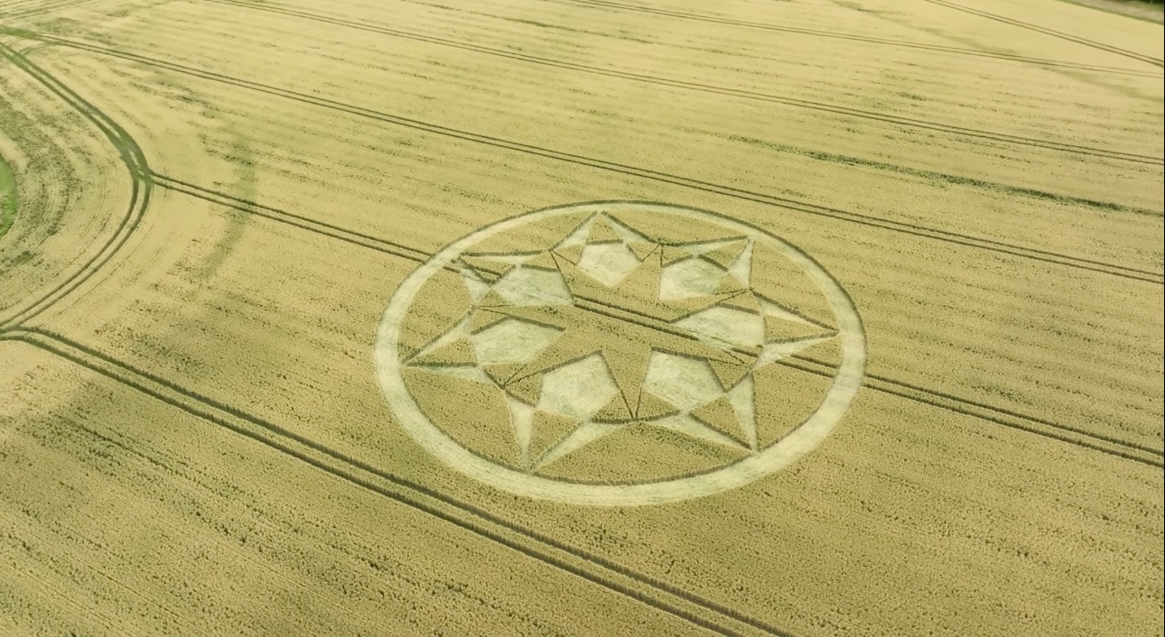
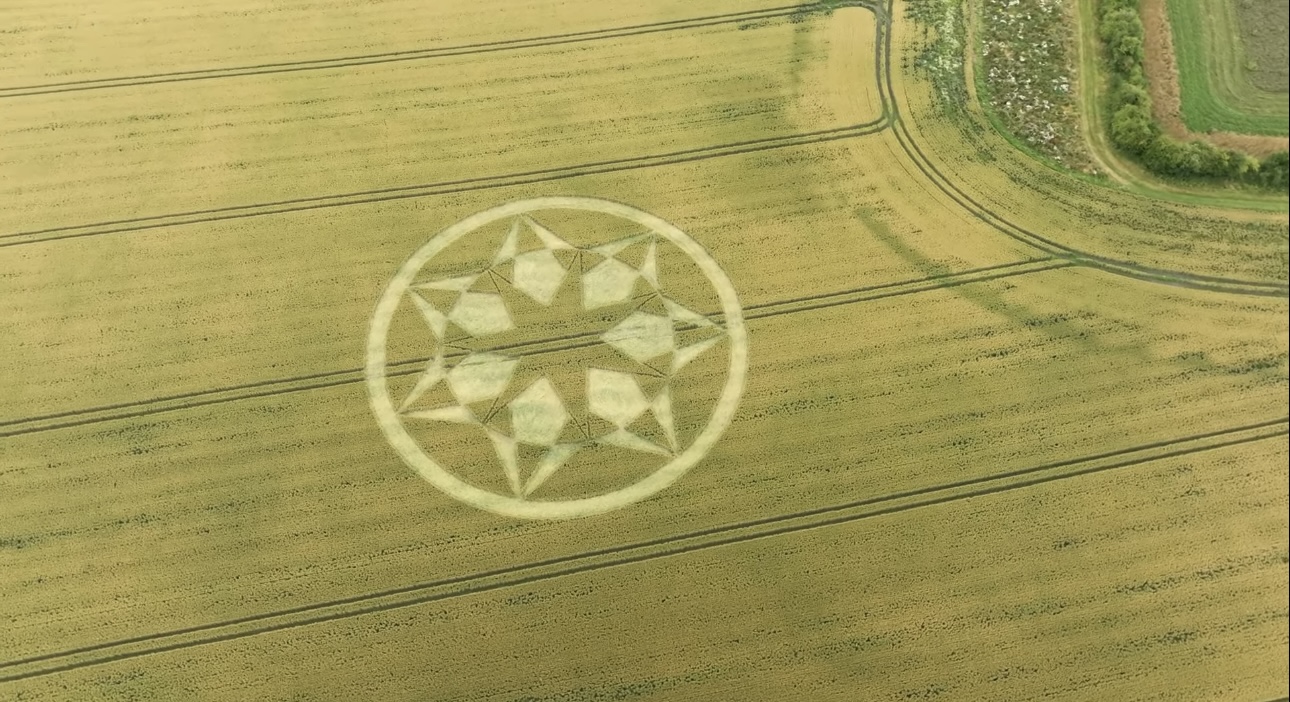
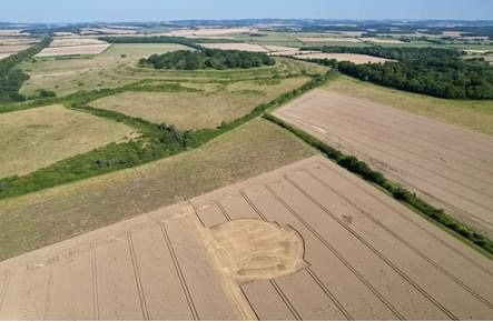
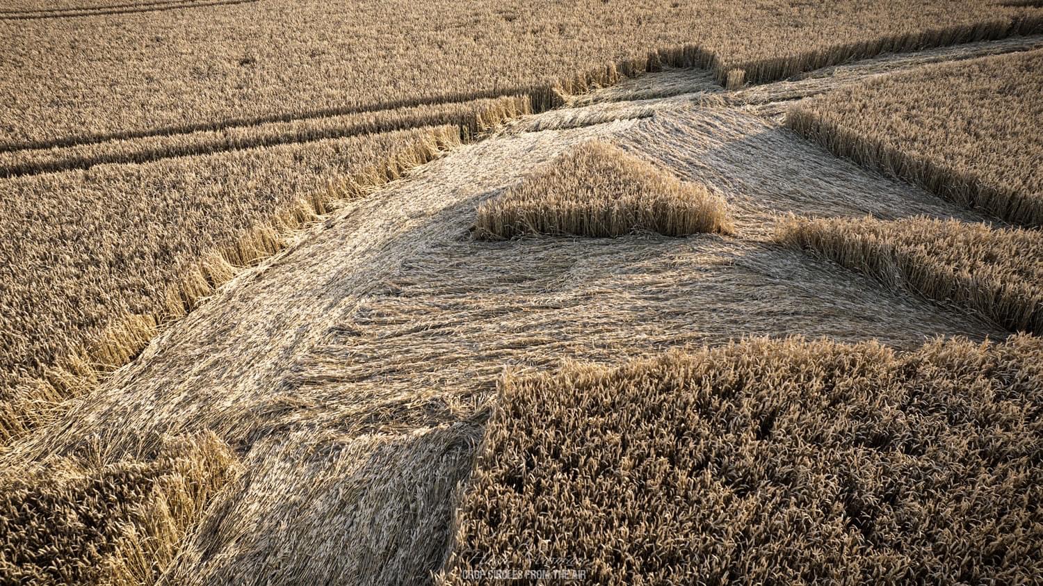
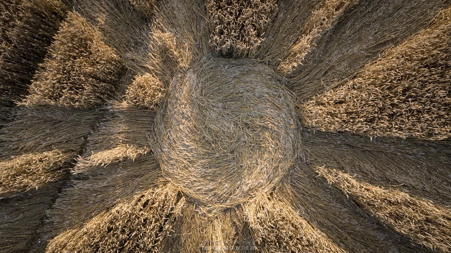
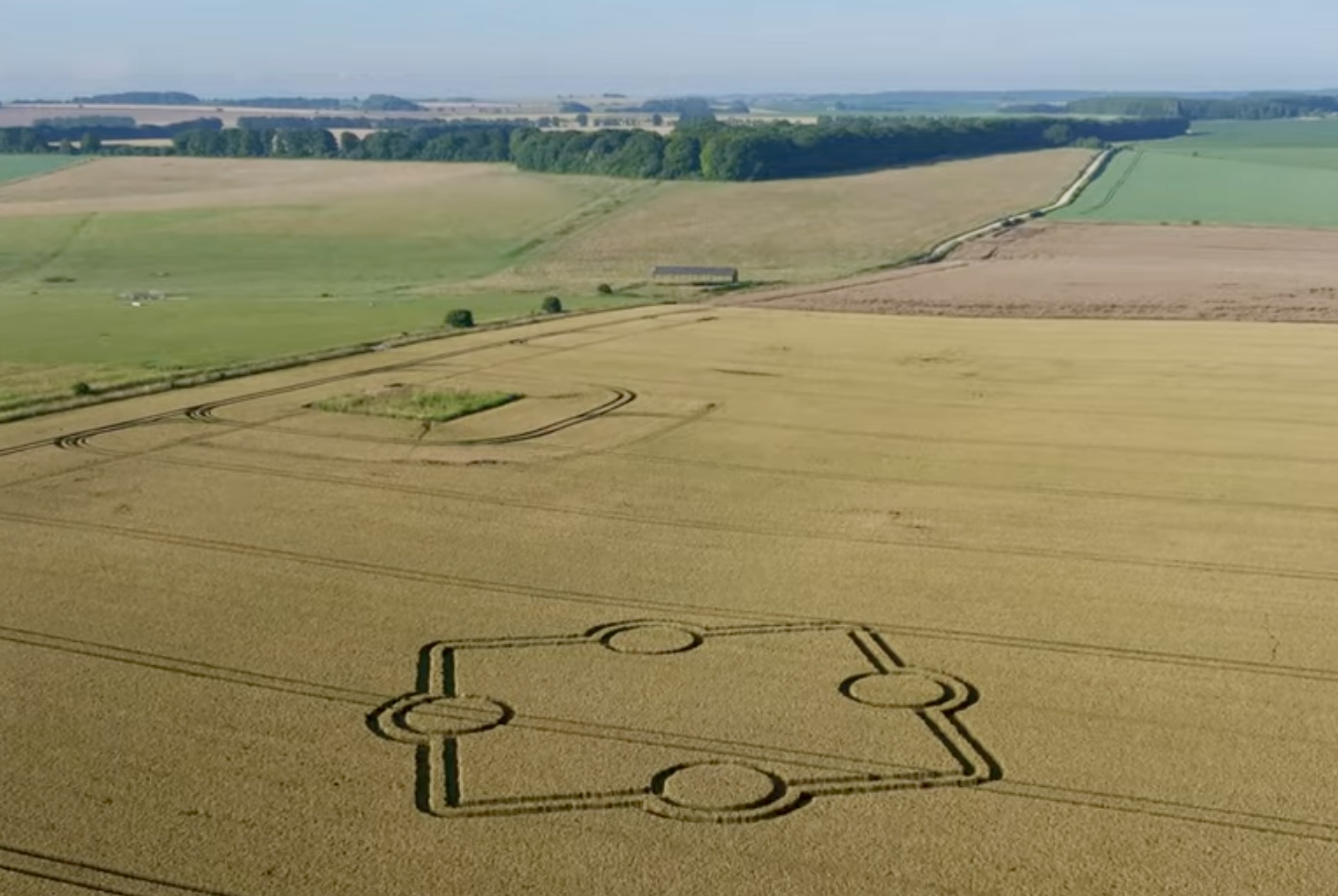
 12th July 2025
Beech Clump, Nr Ludwell, Wiltshire, UK
Crop: Wheat
Size: diameter approximately 100 meters
Photos Nick Bull; Crop Circles from Above and Dan Vidler; ukcropcircles.co.uk
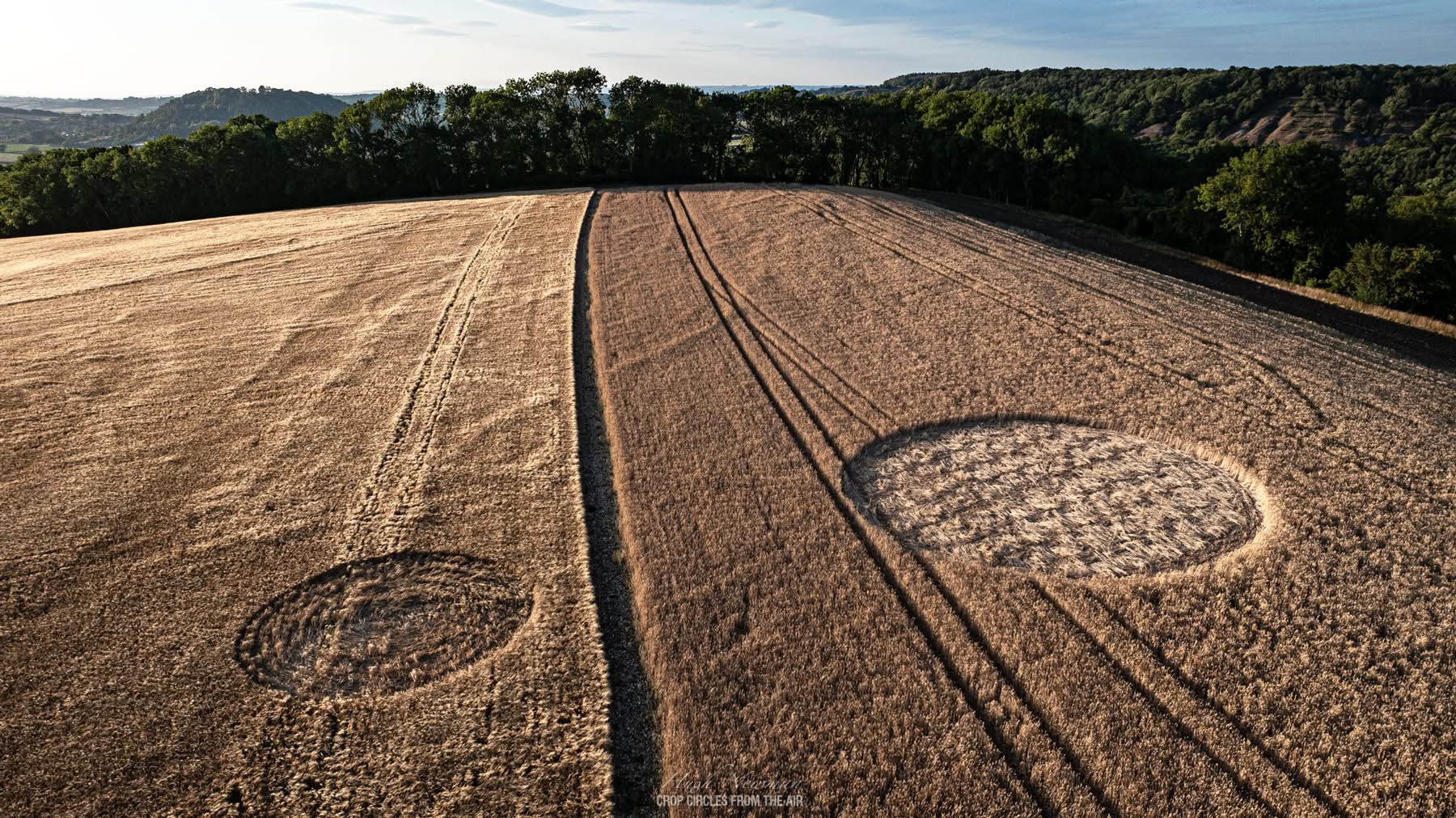
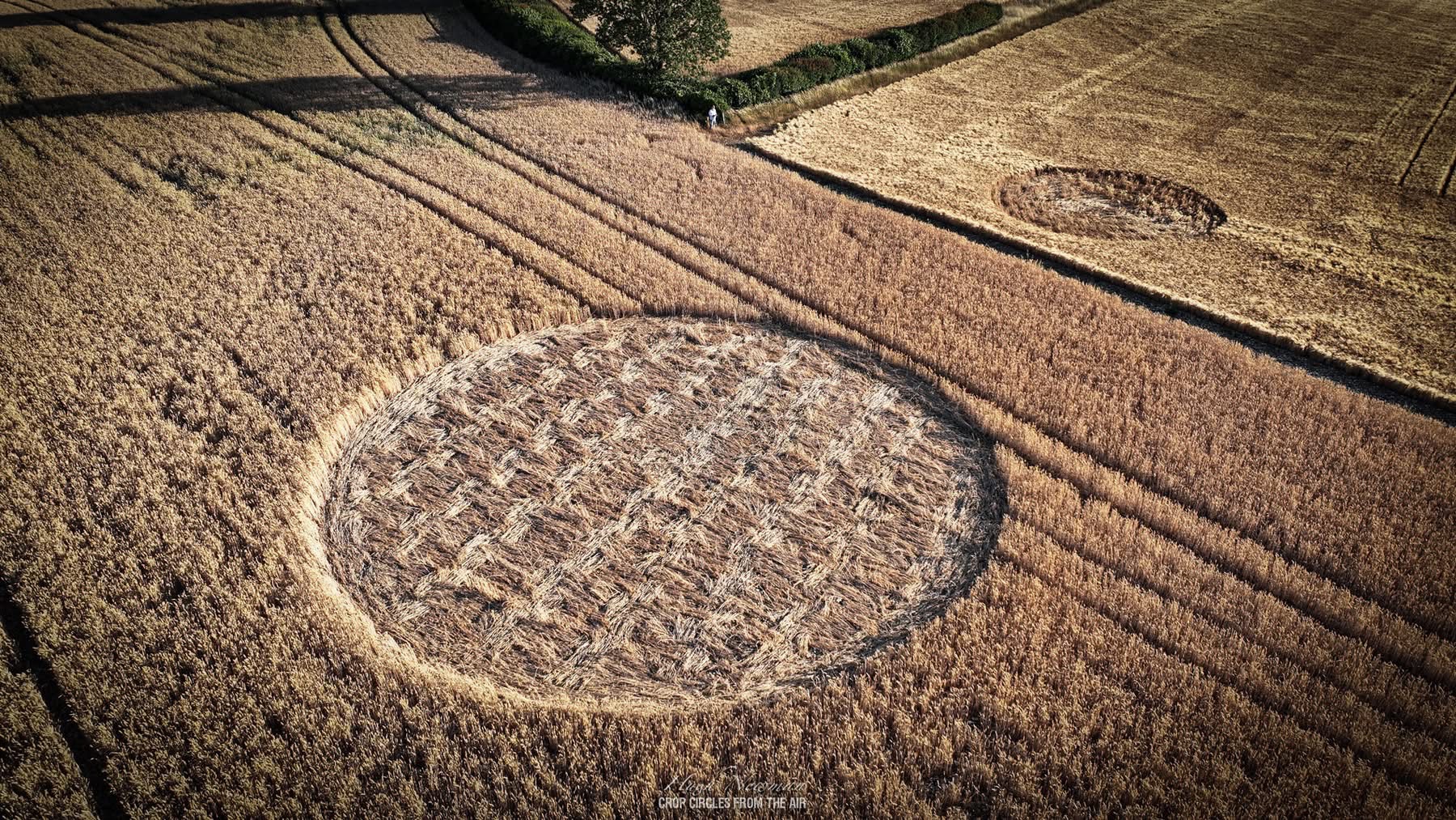
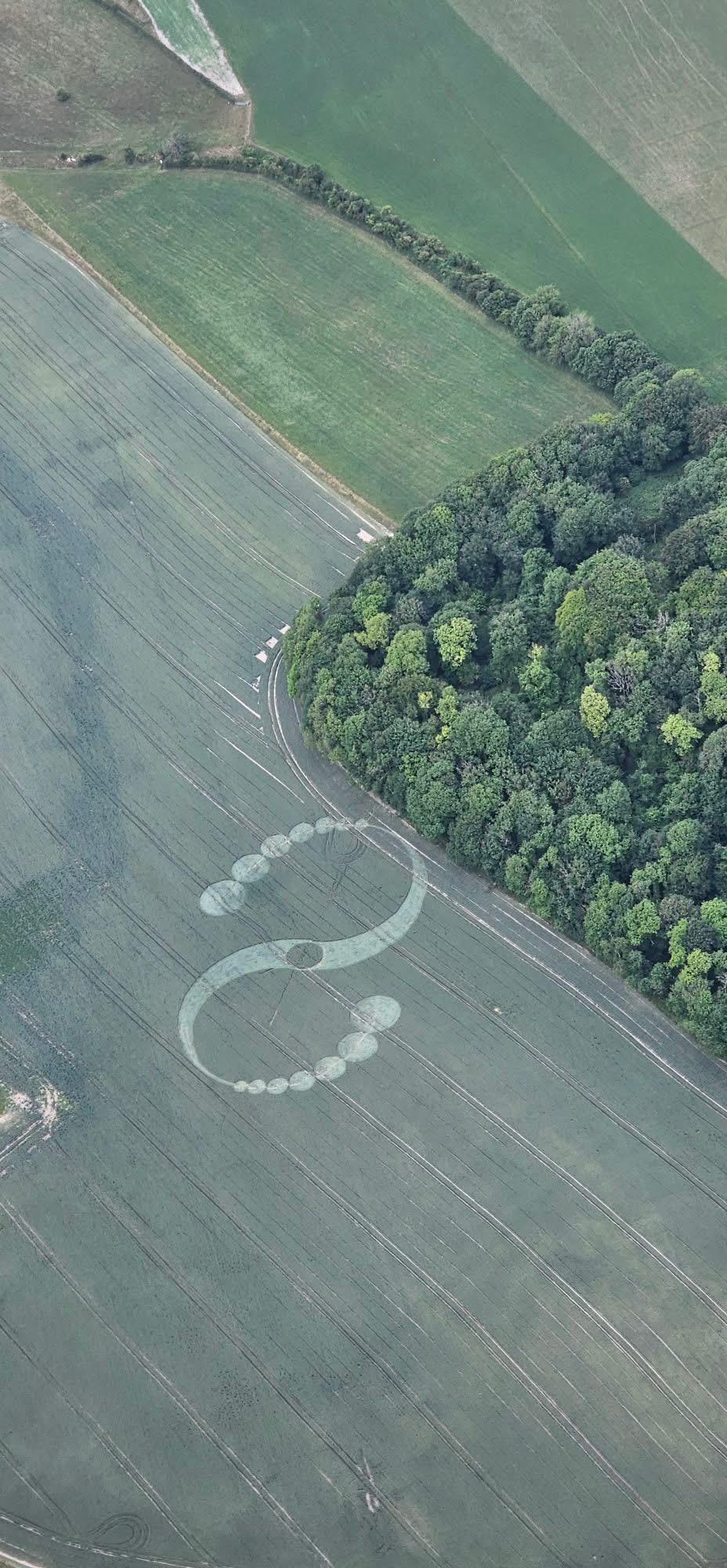
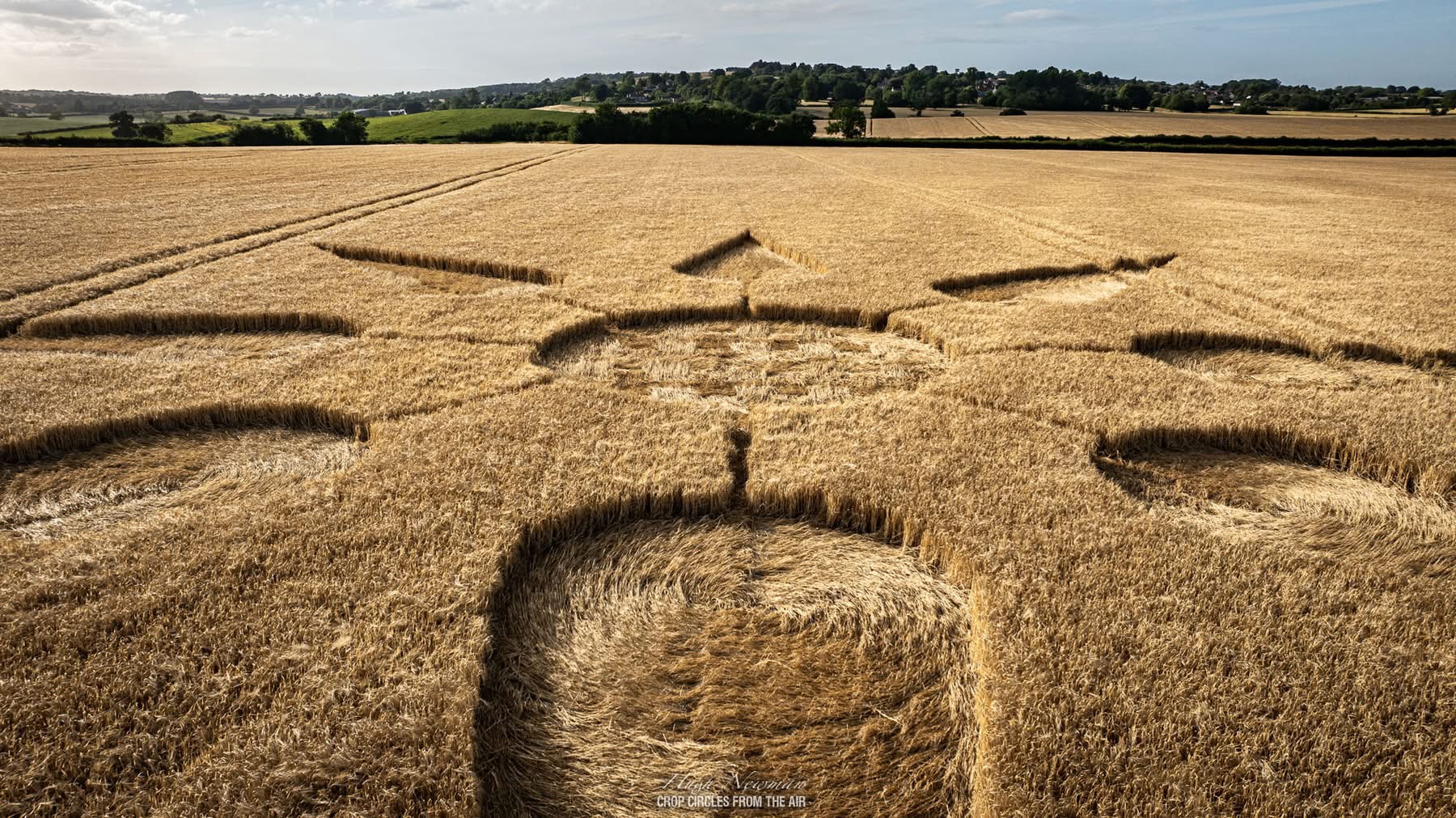
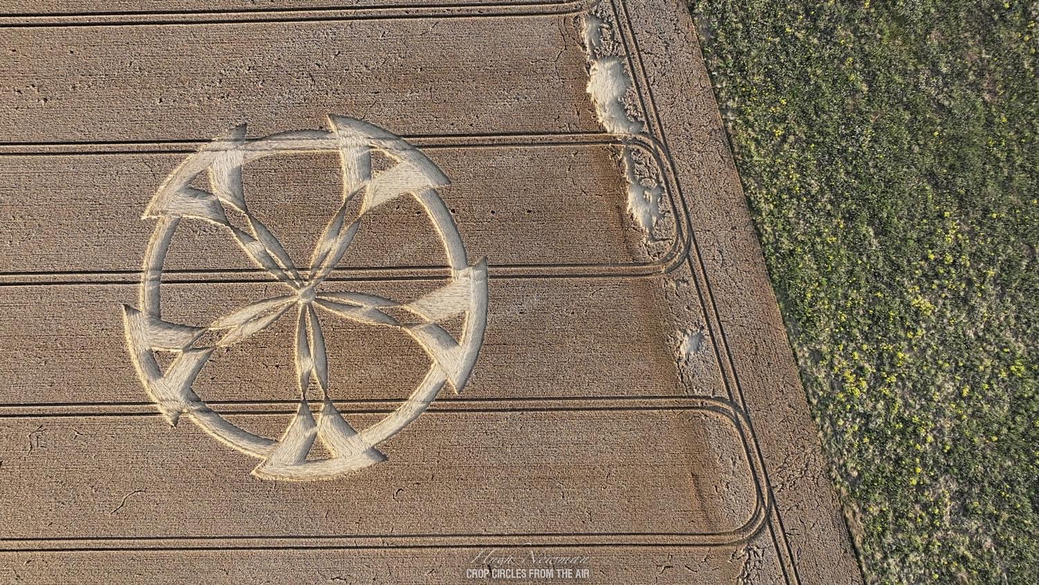
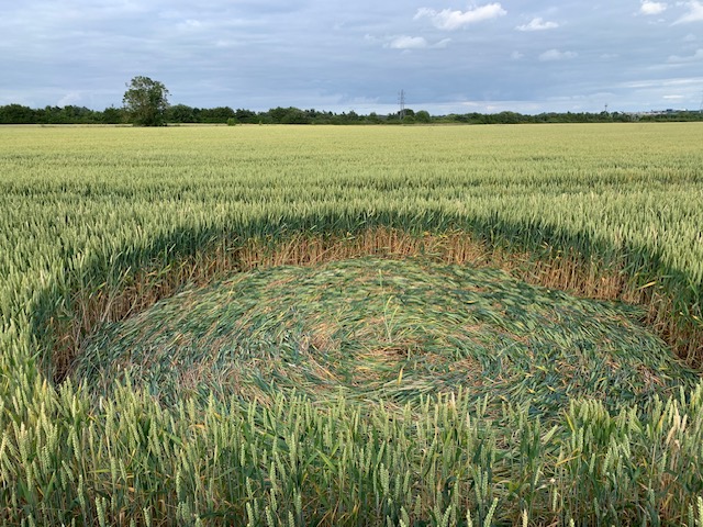
 6th July 2025
Littleton Hill, Somerton, Somerset, UK
Crop: Barley and Wheat
Size: diameter approximately 30 meters and 15 meters
Photos by Hugh Newman; Crop Circles from the Air
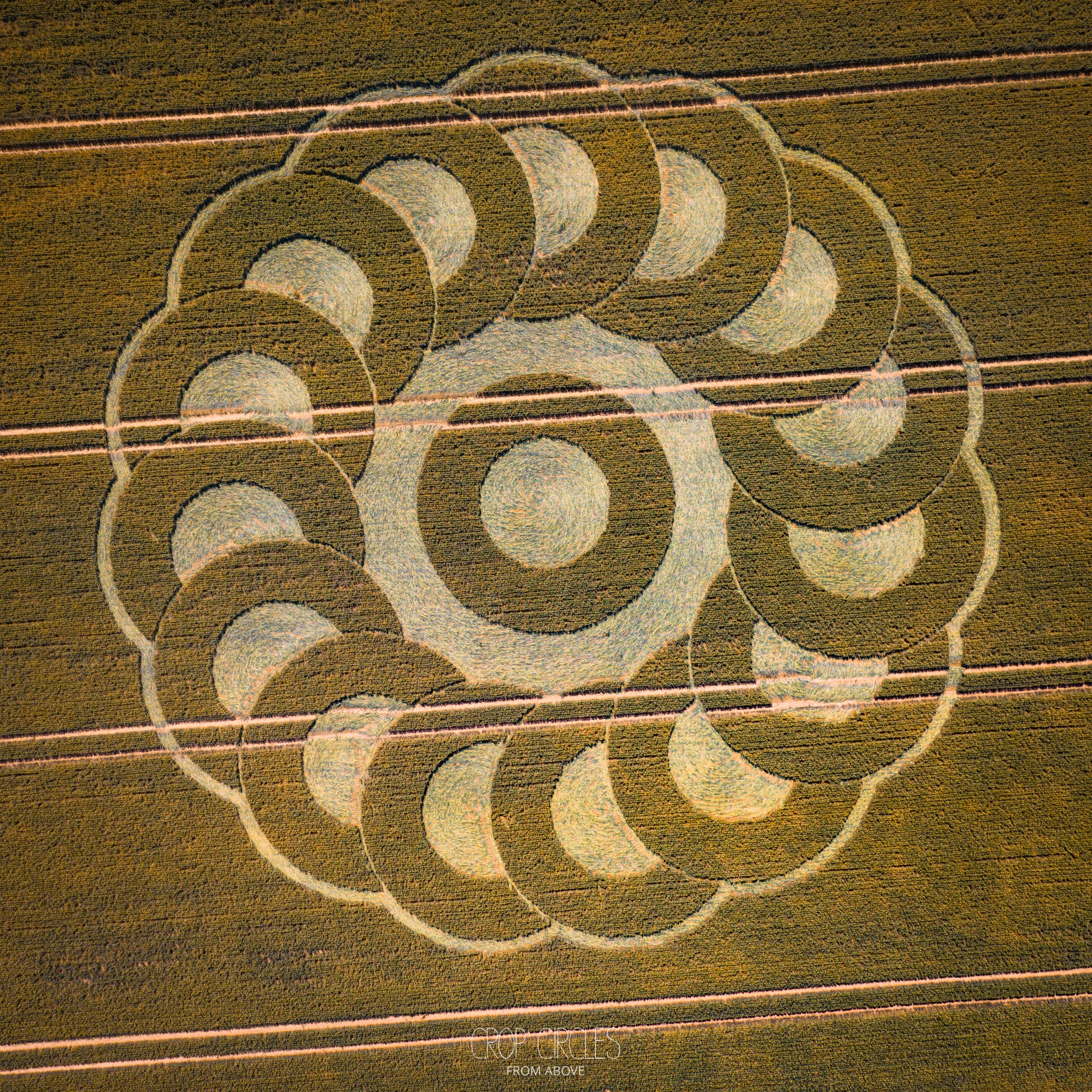
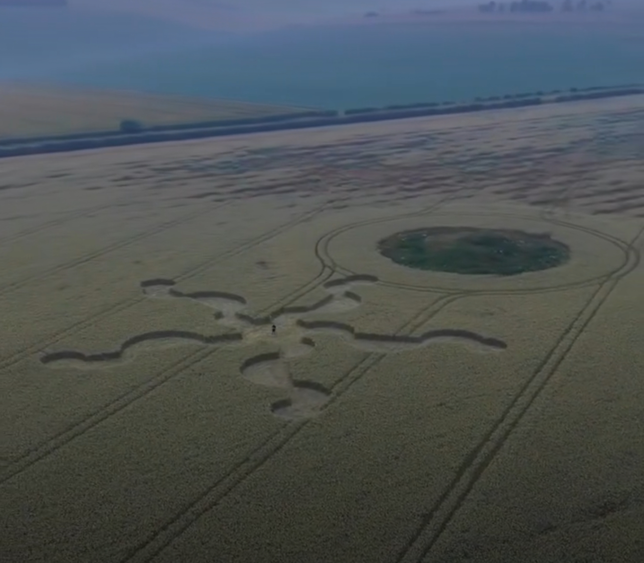
28th June 2025
Ware Farm Manor, Near Lyme Regis, Devon, UK
Crop: Wheat
Size: diameter approximately 100 meters
Photos by Crop Circles from Above,
23rd June 2025
Elliotts’s Shed, Nr Charlton, Wiltshire, UK
Crop: Barley
Size: diameter approximately 120 meters
Photo by Phillip John Andrews
Update: the crop circle has been defaced by the farmer (on 25th June)
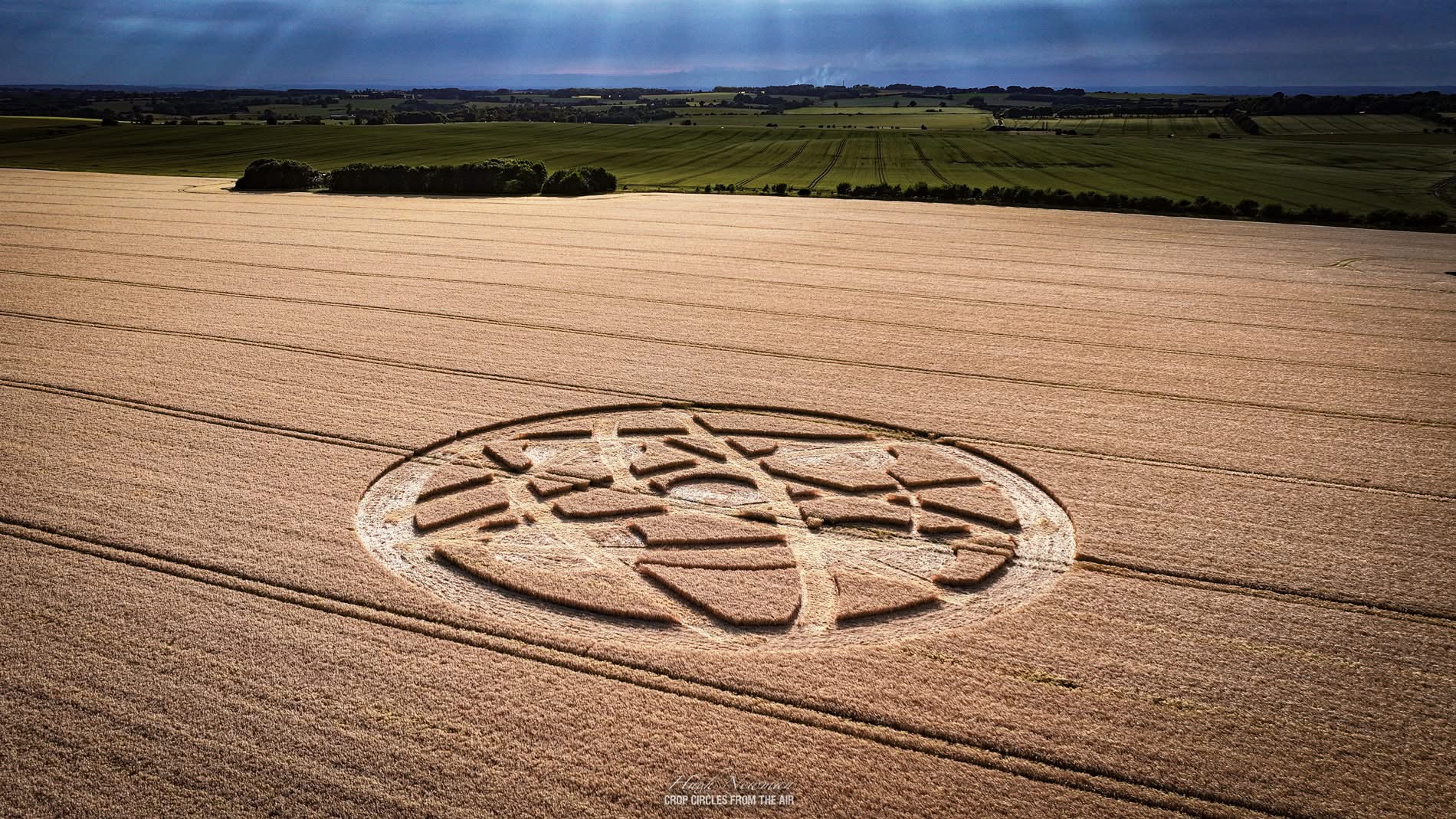
Reported: 22nd June 2025
Hackpen Hill White Horse, Near Winterbourne Bassett, Wiltshire, UK
Crop: Barley
Size: diameter approximately 75 meters
Photos by Crop Circles from Above and Crop Circles from the Air
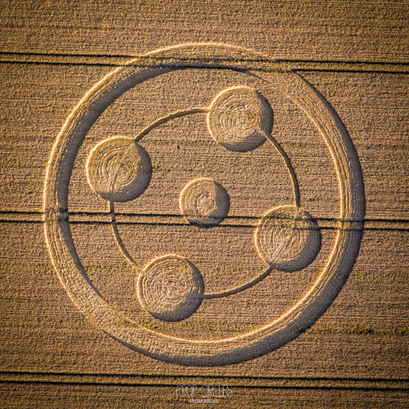
 15th June 2025
Edmund Hill, near Ilchester, Somerset, UK
Crop: Barley
Size: diameter approximately 35 meters
Photos by Hugh Newman; Crop Circles from the Air
8th June 2025
Falkner’s Circle, Near Avebury, Wiltshire, UK
Crop: Barley
Size: diameter approximately 75 meters
Photos by Kathy Mingo
19th May 2025
Please make a donation: https://www.gofundme.com/f/culiford-tree-crop-circle
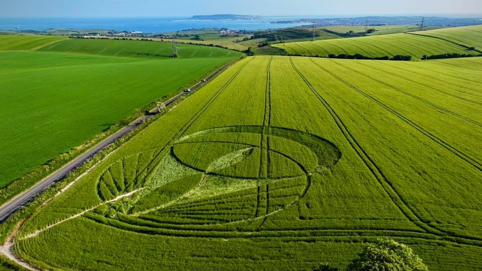
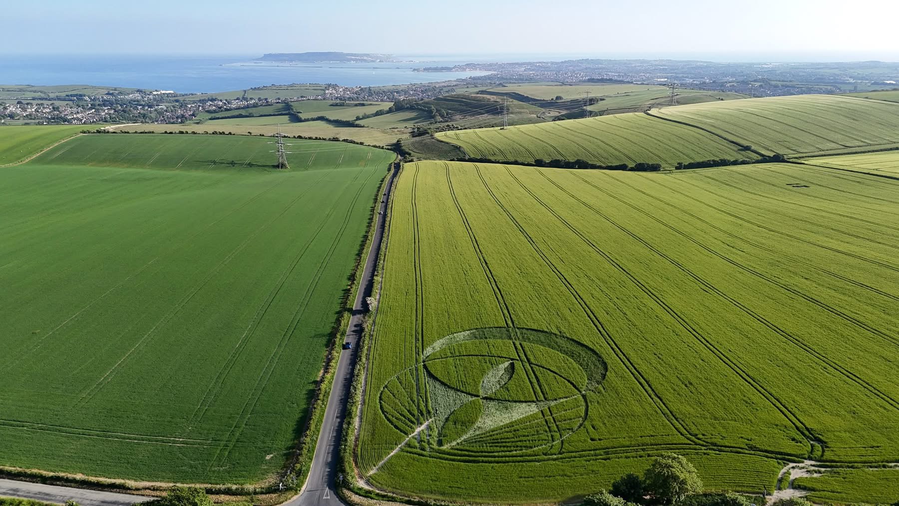
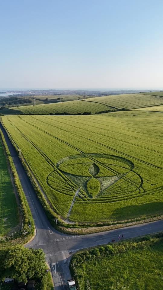
Near Culliford Tree Barrow, Weymouth, Dorset, UK
Crop: Barley
Size: diameter approximately 100 meters
Photos by Billy Breen
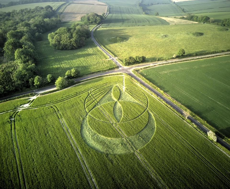
15th May 2025
Sutton Veny, Warminster, Wiltshire, UK
Crop: Barley
Size: diameter approximately 75 meters
Photos by Crop Circles from Above
The first crop circle of 2025 was reported on 11th April 2025
Near Wimbourne, Dorset, UK
Crop: oil seed rape
Size: approximately.
Photo by Geometry, circles and landart

The initial crop circle was reported on 8th August, the addition was reported on 29th August
The Crop Circle can be viewed from the nearby Hill, please park here: Google Maps Link
Near Etchilhampton, Wiltshire, UK
Crop: Wheat
Size: app


 Reported 19th July 2024
Badbury Rings, Dorset, UK
Crop: Wheat
Size: approx. 90 metres
Photos: Hugh Newman, Crop Circles from the air

 Reported 14th July 2024 Near Stonehenge, Wiltshire, UK
Location: Google Maps Link
Crop: Wheat Size: approx. 45 metres
Photos: Stonehenge Dronescapes


