CROP CIRCLES 2022

check below if access is allowed

DJI_0115

Reported 8th August 2022

Etchilhampton Hill, Wiltshire, UK

Google Maps

Size: approx. 90 metres across  

Crop: Wheat

Photo © Stonehenge Dronescapes Photograpy (gallery)

aee5913d-e230-48bb-b02d-a79179b781a4

Reported 3th August 2022

South Field, Wiltshire, UK

THE CROP CIRCLE  CAN BE VIEWED FROM KNAPP HILL

Google Maps

Size: approx. 75 metres across  

Crop: Wheat

Photo © 

d0e3229e-3f63-42b1-bb2a-e3de8843ef13

Reported  28th July 2022

Tawsmead Copse, Wiltshire, UK

Google Maps 

Size: approx. 100 metres across  

Crop: Wheat

Photo © Nick Bull, Stonehenge Dronescapes Photography

1fc8b2af-5be7-4c15-acb9-c58b99c91f0e

Reported 24th July 2022

Etchilhampton Hill, Near Devizes, Wiltshire, UK

Google Maps

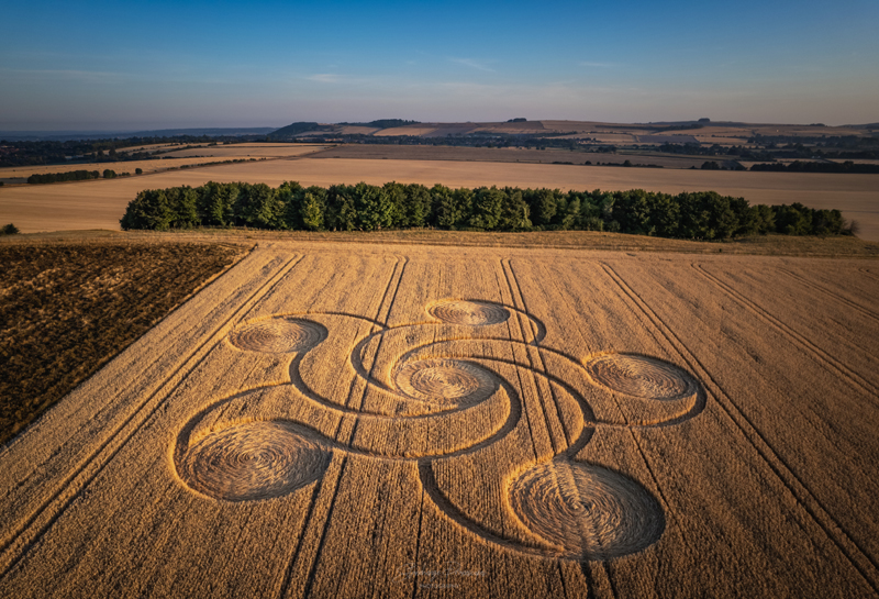
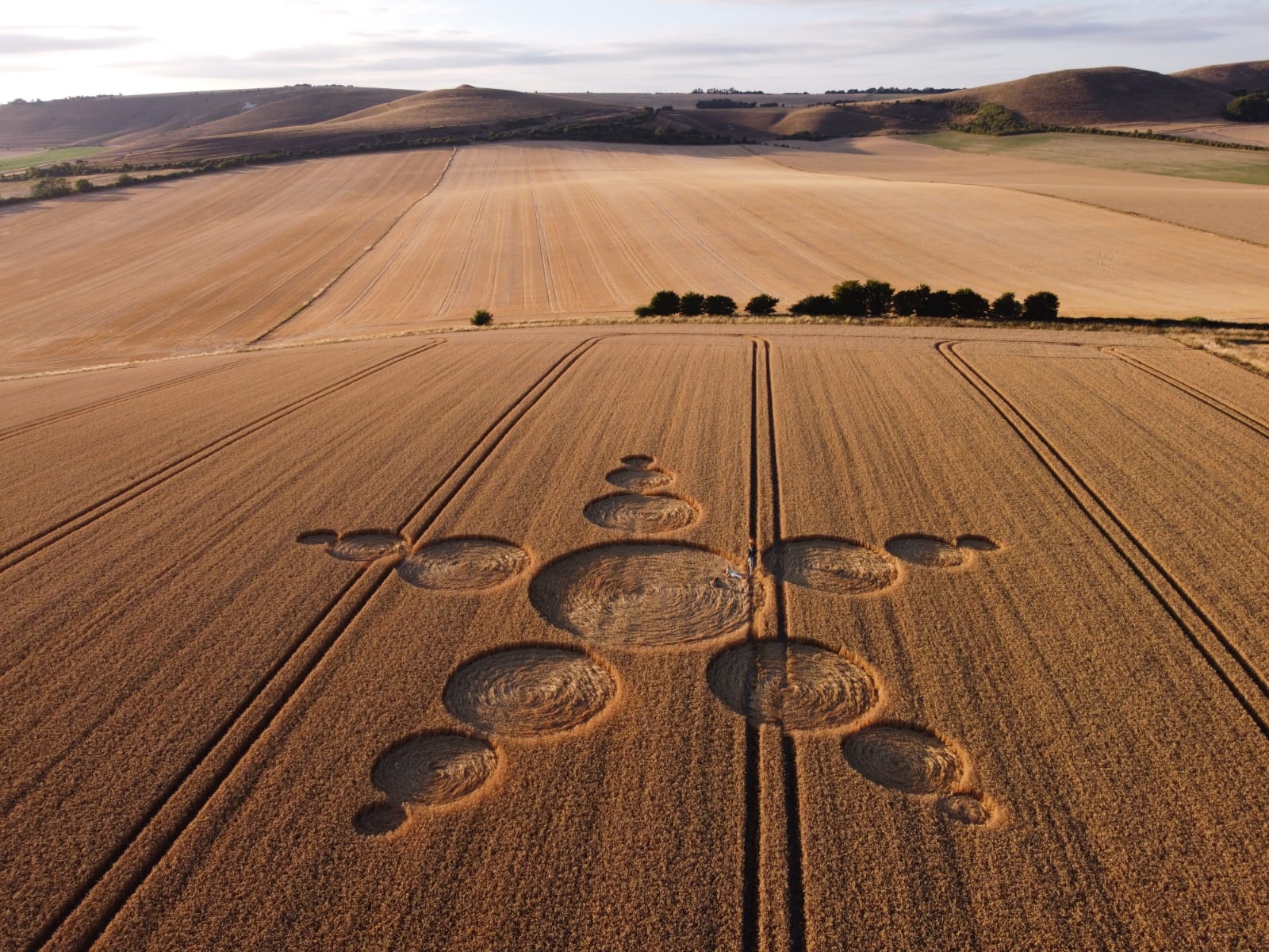
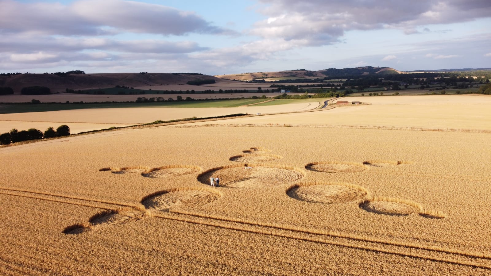
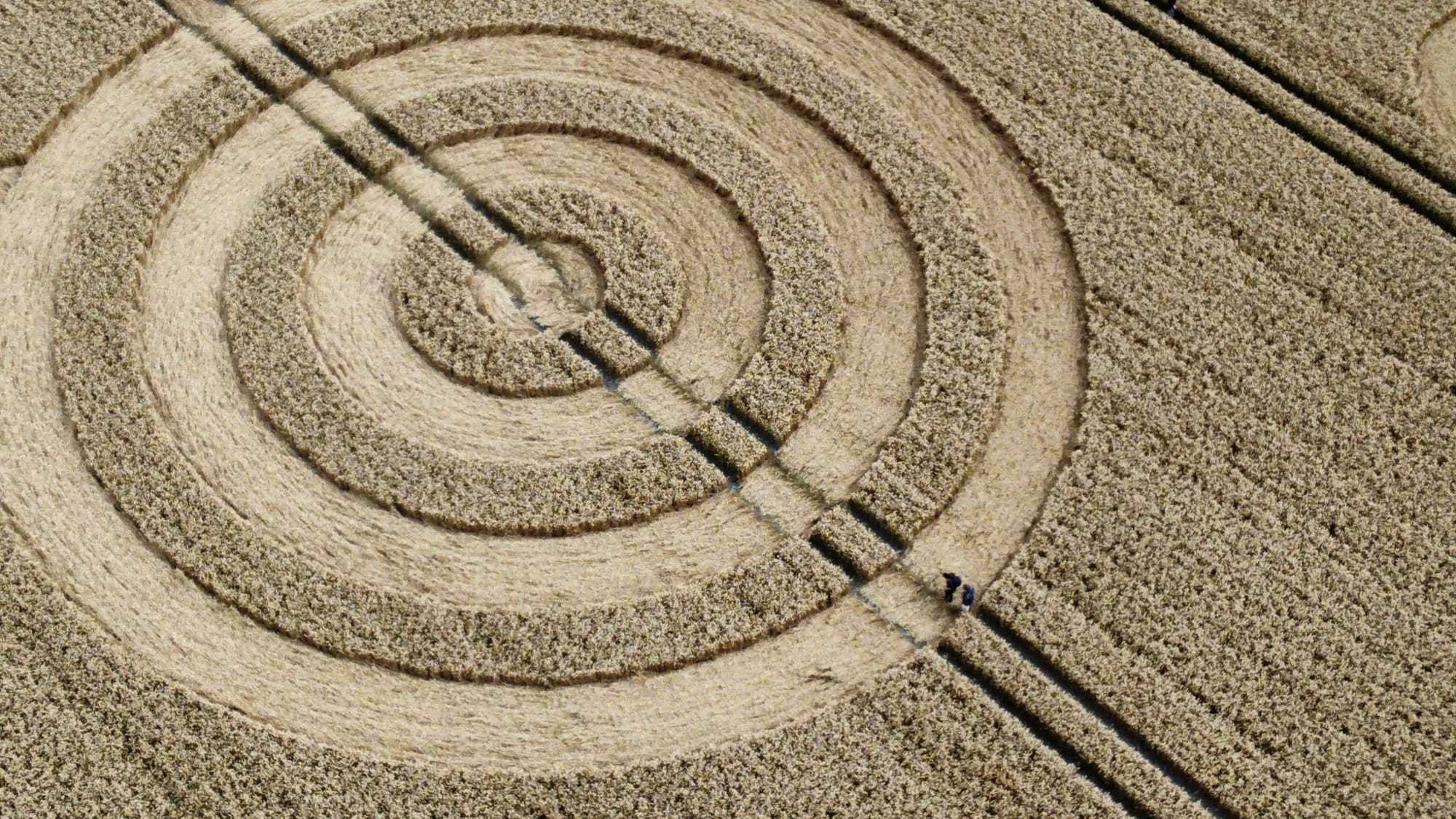
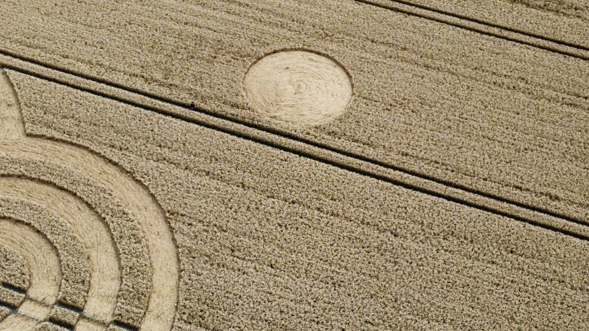
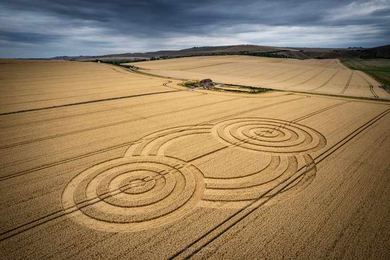
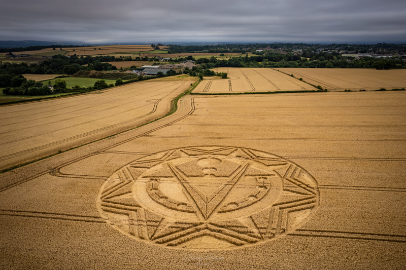
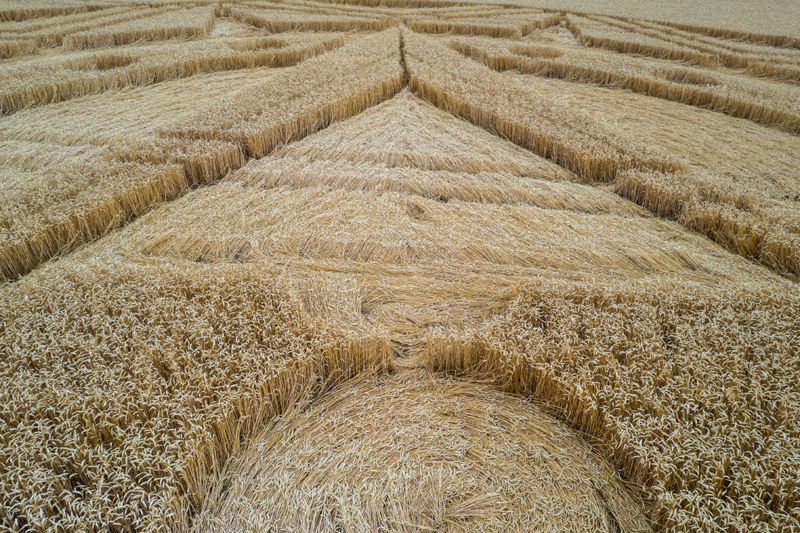
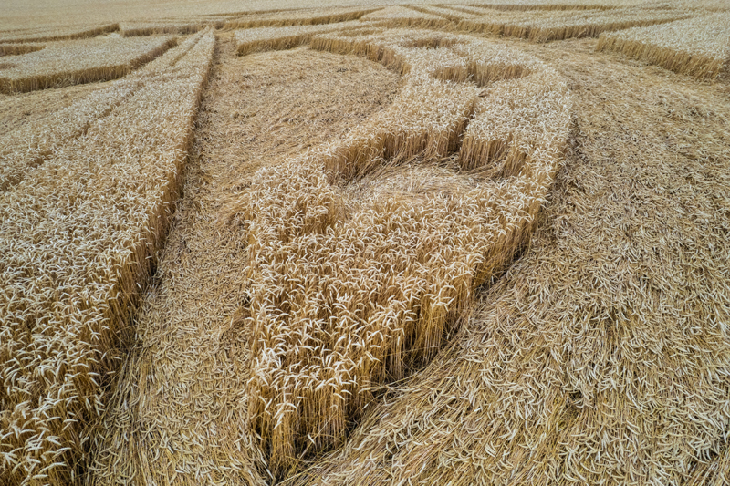
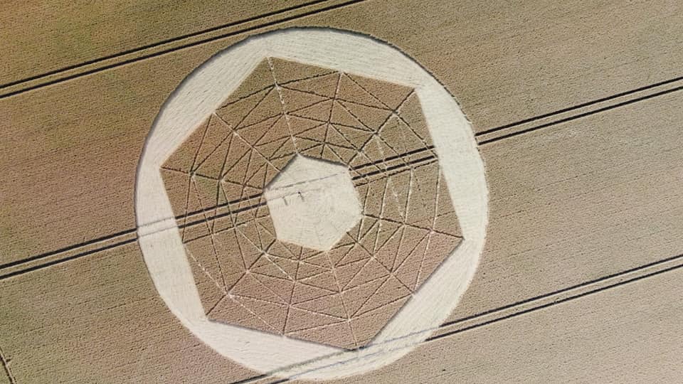
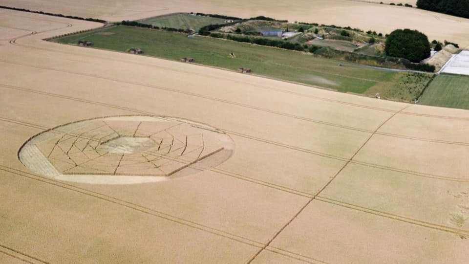
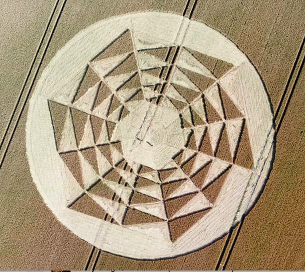
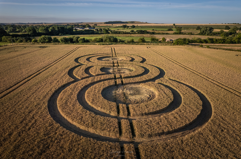
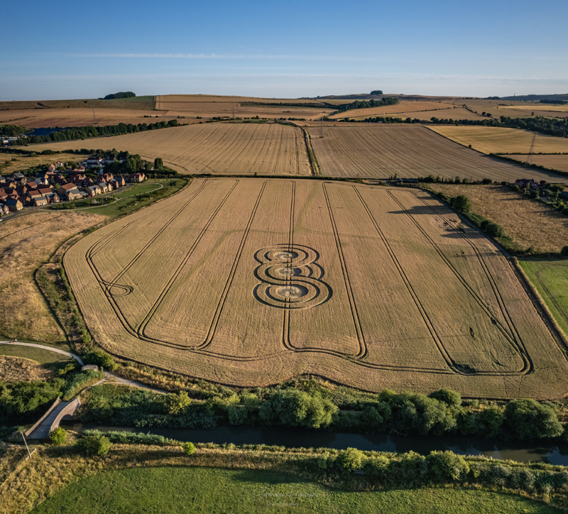
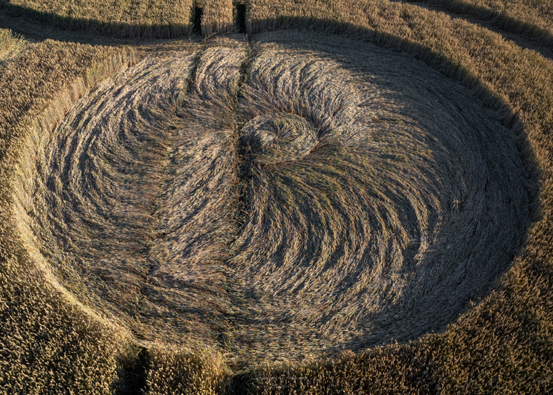
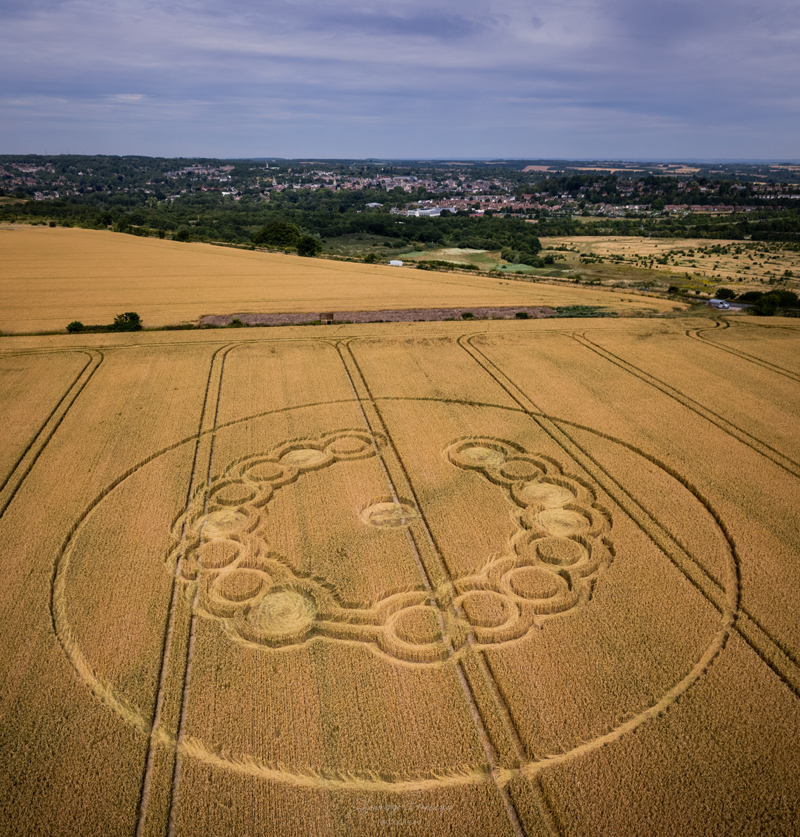
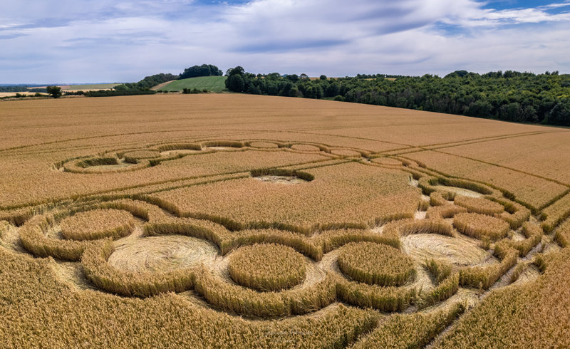
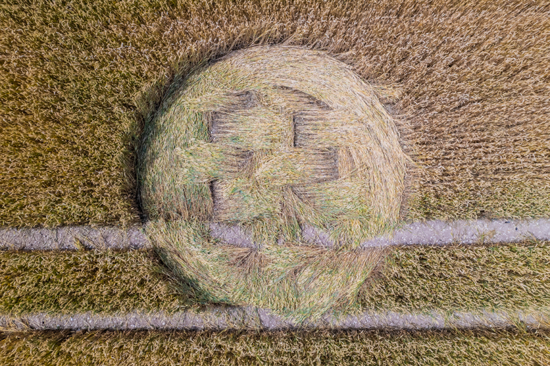
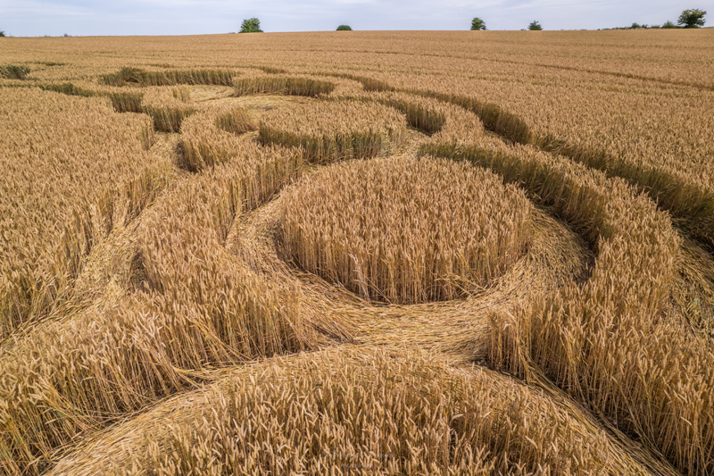
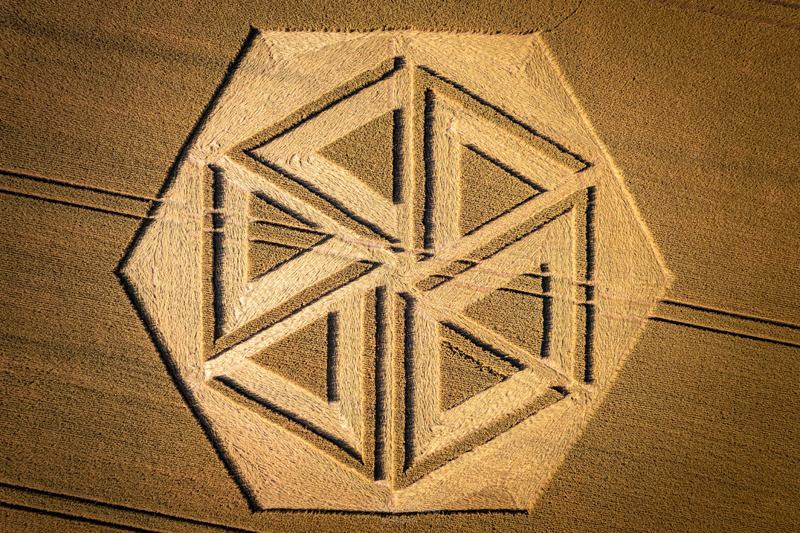
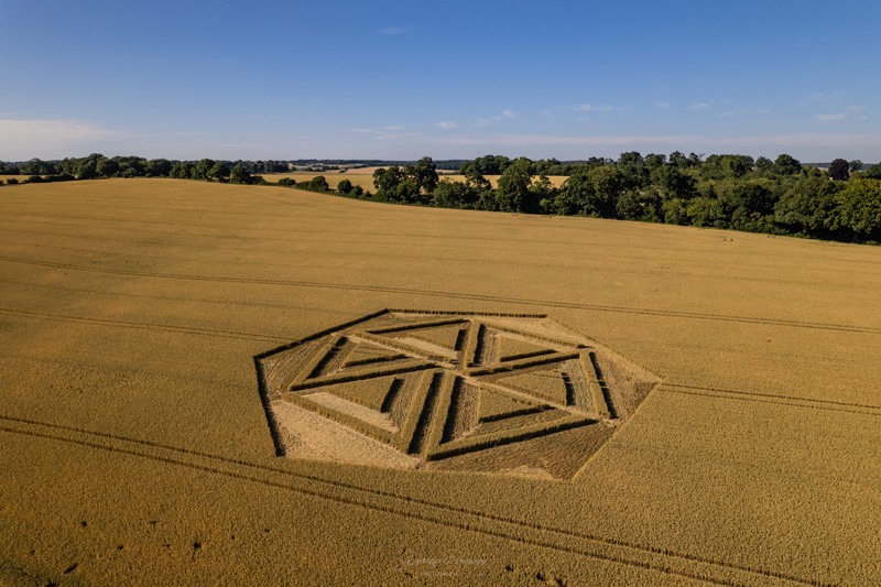
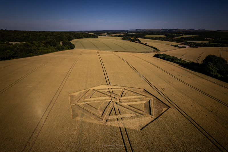
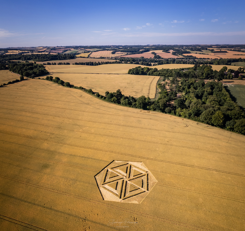
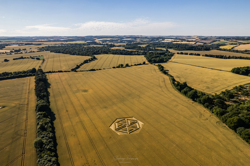
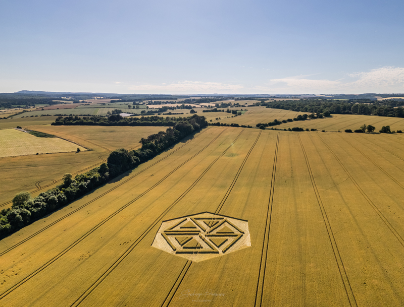
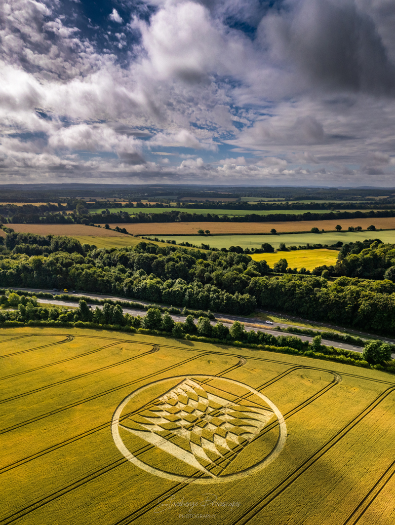
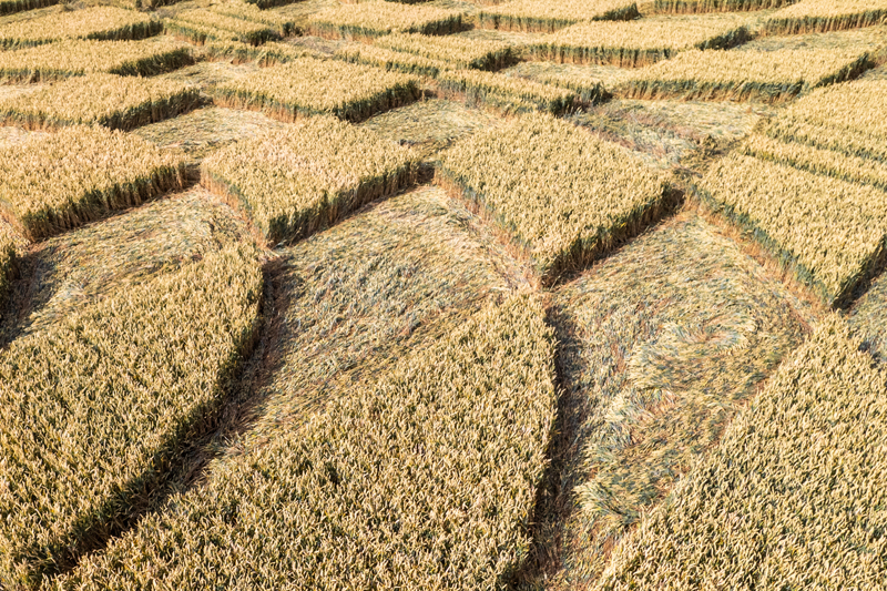
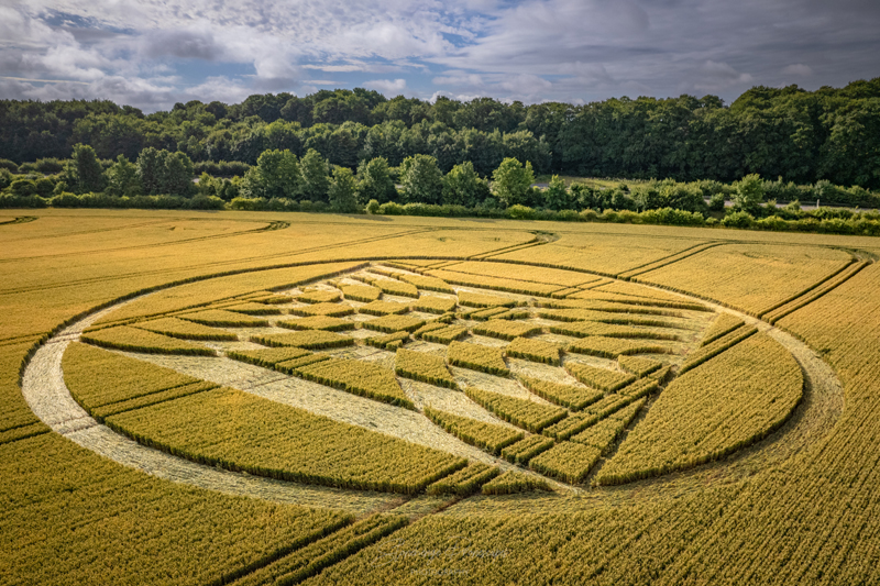
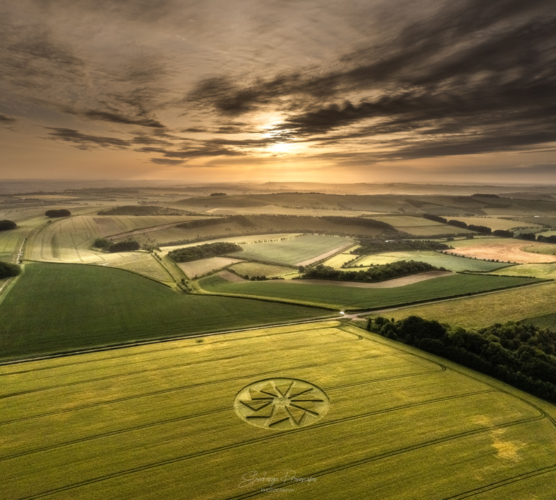
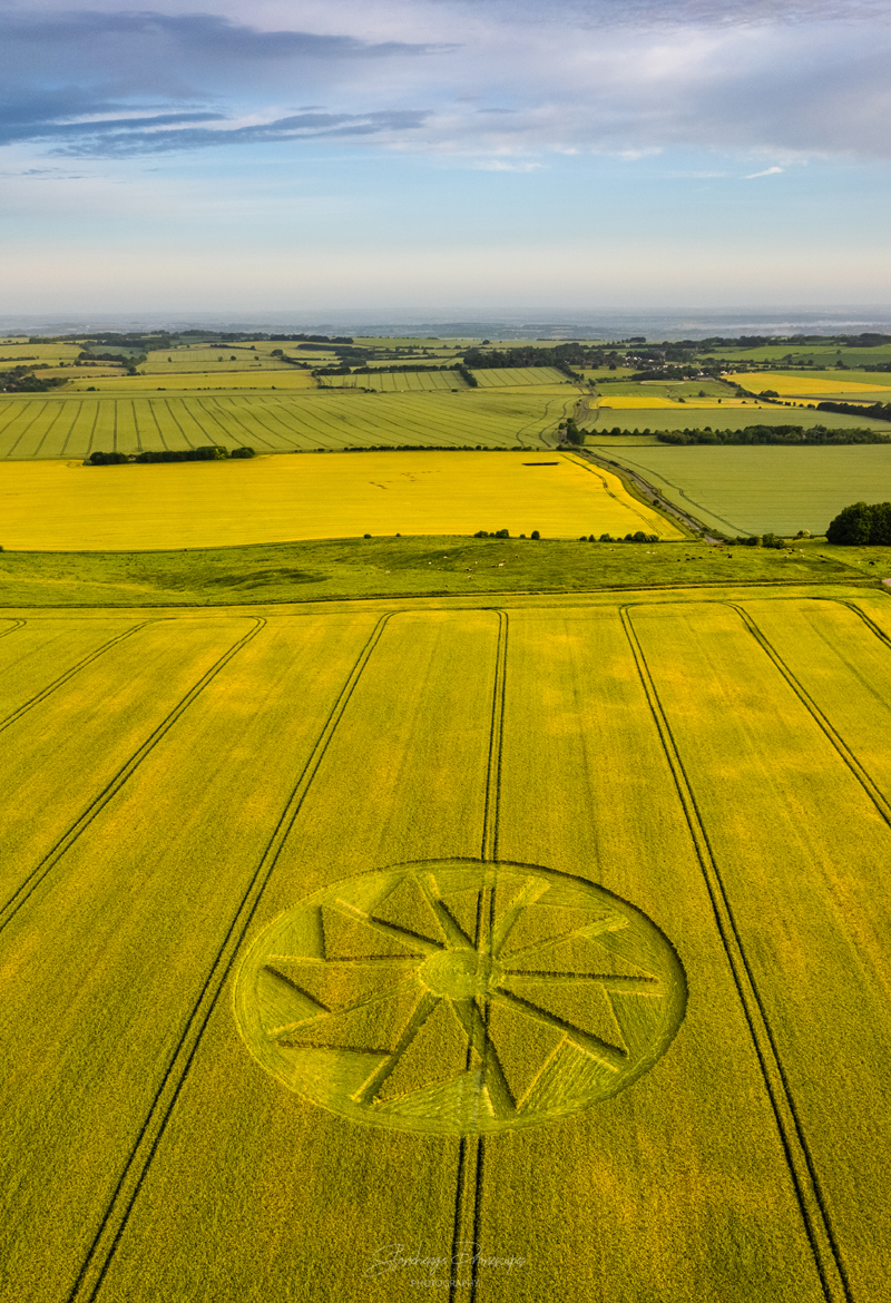
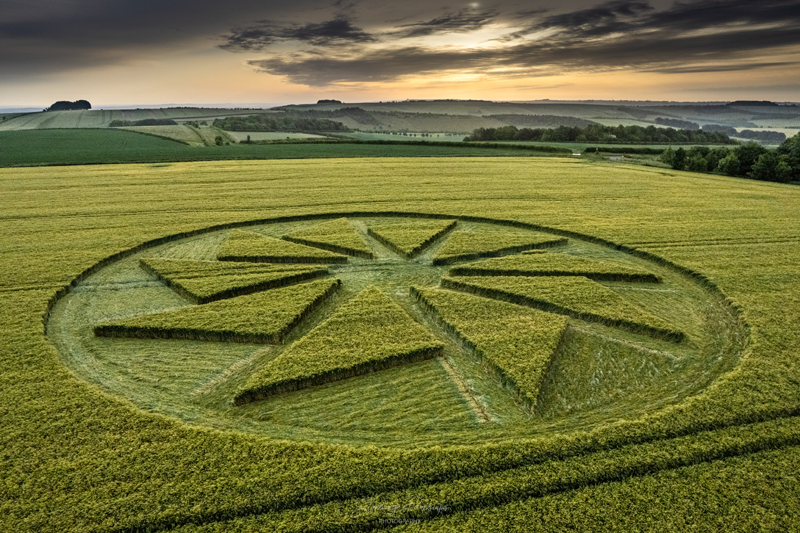
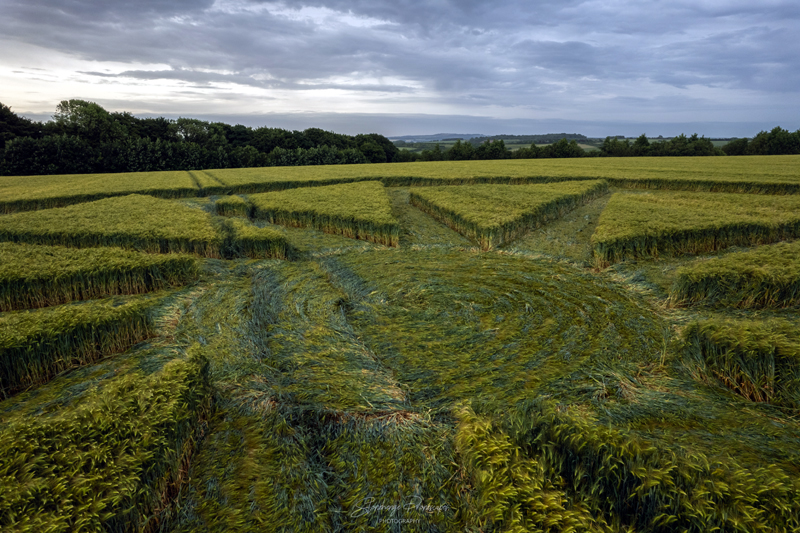
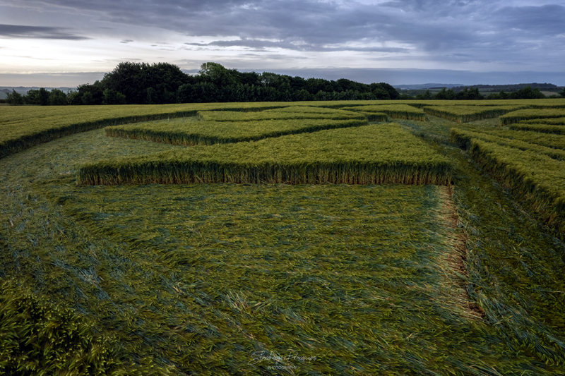
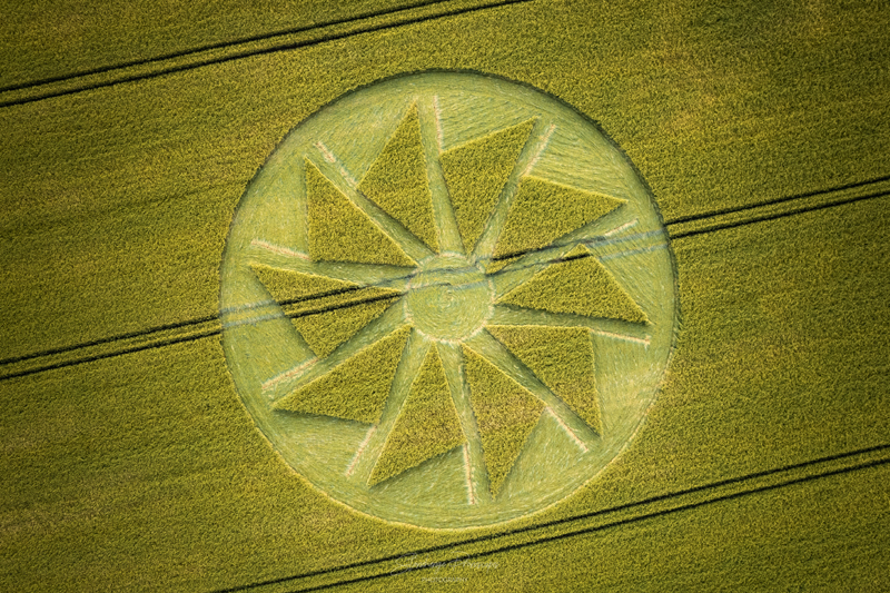
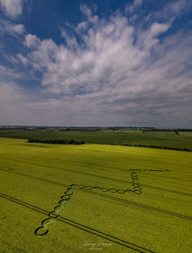
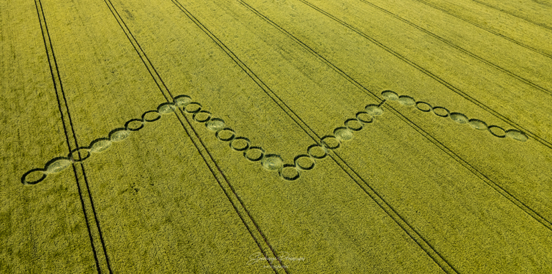
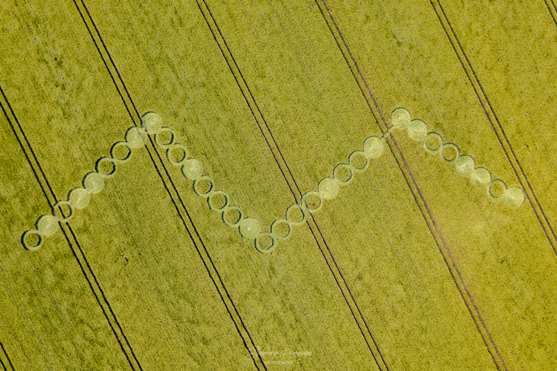
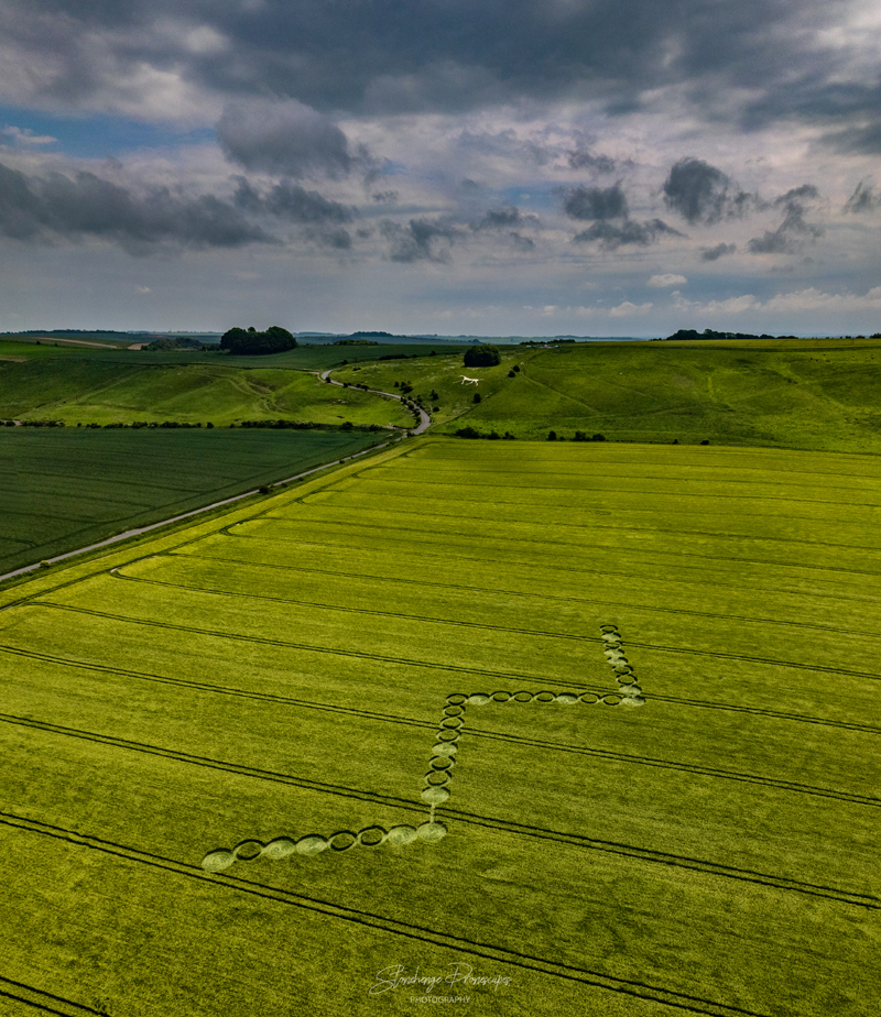
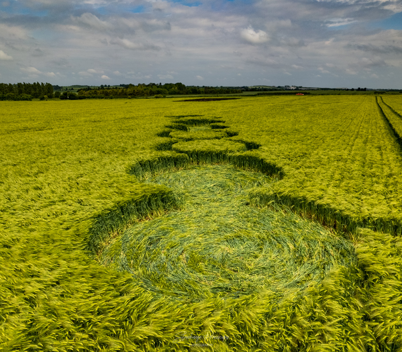
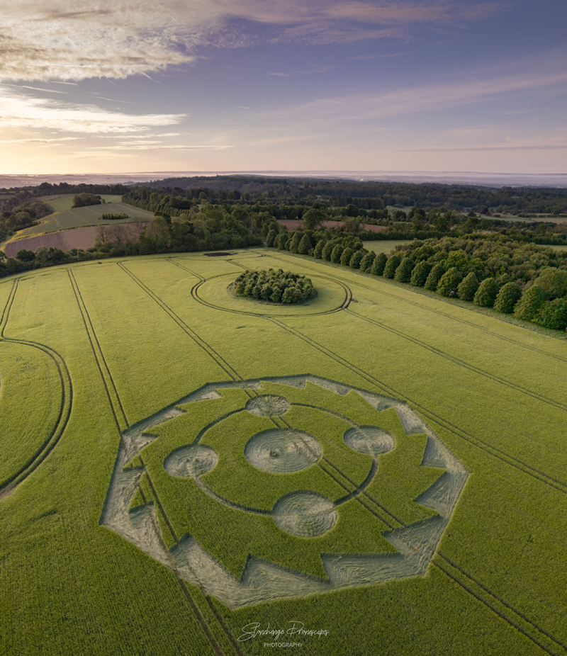
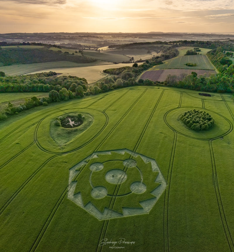
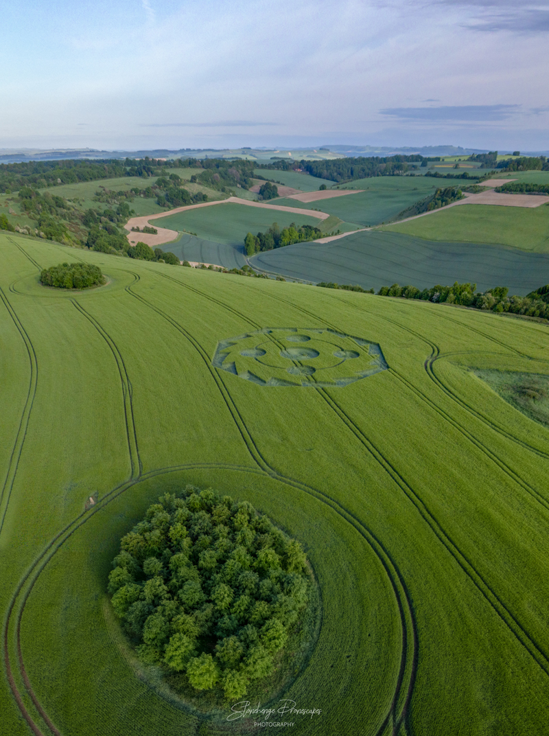
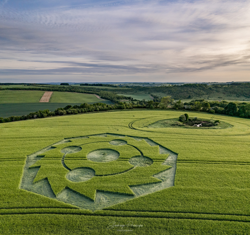
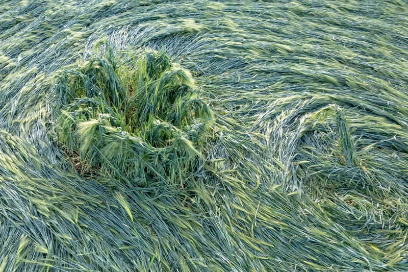
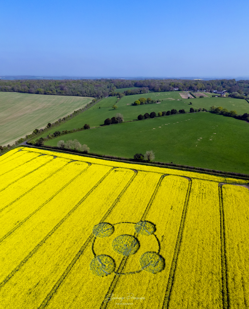
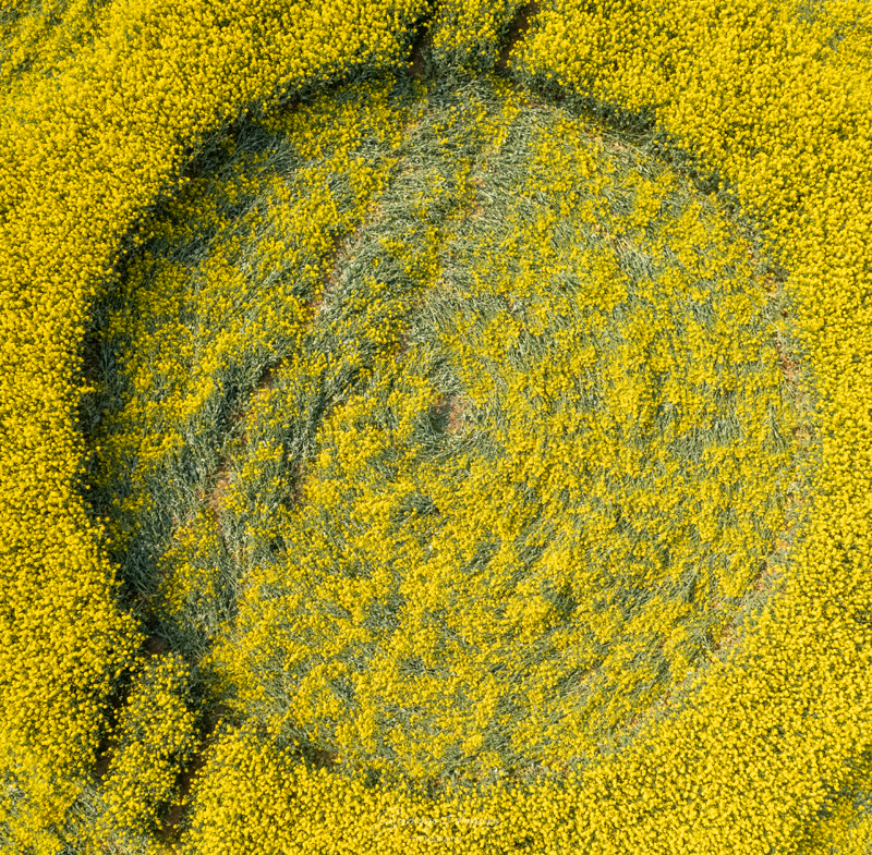
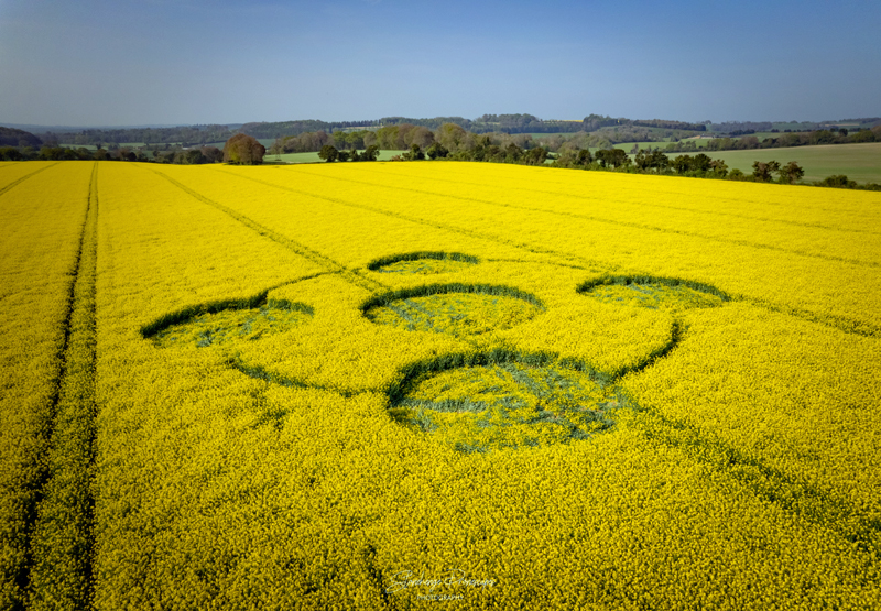
The farmer has been so kind to grant permission to people who would like to visit the formation. Entry is donation based (suggested donation 2,50 pp) for a charity of his choice. Donations are collected at the Crop Circle Visitor Centre in Honeystreet. Please donate generously.

Size: approx. 90 metres across  

Crop: Wheat

Photo © Kathy Mingo and Stonehenge Dronescapes Photograpy (gallery)

Schermafbeelding 2022-07-18 om 11.47.51

Reported 17th July 2022 and altered on Monday 18th July 2022

Barbury Castle, Wiltshire, UK

THE CROP CIRCLE  CAN BE VIEWED FROM THE HILLTOP

Google Maps

Size: approx. 75 metres across  

Crop: Wheat

Photo © Kathy Mingo

DJI_0320

Reported 14th July 2022

Lay Wood, Nr Devizes, Wiltshire, UK

Google Maps 

Size: approx. 100 metres across  

Crop: Wheat

Photo © Nick Bull, Stonehenge Dronescapes Photography

DJI_0258

Reported Tuesday 12th July 2022

Pilgrim’s Trail, Near Winchester, Hampshire, UK

 Google Maps

Size: approx. 100 metres across  

Crop: Wheat

Photo © Nick Bull, Stonehenge Dronescapes Photography

hugh11072022c

Reported 9th July 2022

Cake Wood,  Near Froxfield, Wiltshire, UK

Map:  SU2950268942

Size: approx. 70 metres across  

Crop: Wheat

Photo © Hugh Newman and Nick Bull (Gallery)

DJI_0805

Reported 3th July 2022

Near Micheldever Station, Hampshire, UK

Map:  SU5033243058

Size: approx. 90 metres across  

Crop: Wheat

Photo © Nick Bull

image

Reported 19th June 2022

Near Hackpen Hill Horse, Wiltshire, UK

Map: SU1300474445

Size: approx. 70 metres across  

Crop: Barley

Photo © Nick Bull

DJI_0929

Reported 4th June 2022

Owl House, Near Hackpen Hill, Wiltshire, UK

Map: SU1217074981

Size: approx. 130 metres across  

Crop: Barley

Photo © Nick Bull

DJI_0765

Reported 22nd May 2022

Little Down, Near Hippenscombe, Wiltshire, UK

Map: SU3086055367

Size: approx. 100 metres across  

Crop: Barley

Photo © Nick Bull

DJI_0071

Reported 24th April 2022

Enmill Barn, near Crab Wood, Winchester, Hampshire, UK

Size: approx. 100 ft across  

Crop: Oil Seed Rape

Photo © Nick Bull